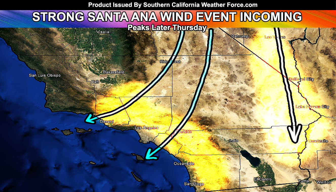
The Southern California Weather Force has issued a Santa Ana Wind Watch effective this Thursday into Friday, which does include an elevated fire danger risk. Read on for details…
Well it’s that time again.. a storm system sliding to our east on Wednesday and Thursday will begin the process for Santa Ana Winds to develop. These winds will start on Thursday and increase as the day moves on, peaking Thursday evening, which is interesting because most of the time the winds peak in the mid-morning hours. But.. with the evening arrival will come gusty winds that will affect travels in and out of the Ontario International Airport areas, including cancellations and/or delays and even diverts to other airports with arrivals.
Wind gusts may reach 40-60 mph in the Santa Ana Wind prone zones with a median of 30-45 mph. Some areas could reach higher than 70 mph, with even higher gusts in the nominal hit pass and canyon regions.
Due to the thermal support.. these winds will not feel like the 100 degree winds of Fall and we have yet to see those this season, another odd thing. These will feel on the cold side. Upper support is there out of the northeast so what I’m expecting is less wind in San Diego County and more wind in the prone zones of Ventura, Los Angeles, Kern, and The Inland Empire forecast zones.
Because this is a Santa Ana Wind Watch with drier conditions.. fire risks are indeed elevated and it will act as a Fire Weather Alert as well.
The member section this evening will have the first gust forecast with my new category system for wind events. Stay tuned …
End
NOTE: Premium members. If you are signed up, your login is your e-mail address and the username and password as the password. You can change the password
Ongoing Ad – The Southern California Weather Force has a member section with LIVE UPDATES FOR EVENTS and rain, wind, thunder, tornado etc models that are personally updated by me with each Santa Ana Wind or storm event. You also can get e-mailed alerts via a slew of micro-climates. Check the member section for details on how you can support this service.. along with getting service in return… Click Here To Join or Upgrade Via The Member Section
Please remember if upgrading to CANCEL YOUR PAYPAL PAYMENTS. Login and cancel the reoccurring payments.
The Southern California Weather Force has different Facebook groups that you can ask for notifications from in order to get the latest posts affecting those regions. If that area is talked about in an article, alert, and such .. it’ll be posted there and you can be notified.
Comments are usually DISABLED as we do like to keep this as an information giving group and replies from others in the notification may annoy some.
Find your micro-climate group here – https://www.southerncaliforniaweatherforce.com/scwf-weather-alert-facebook-groups-by-region/
EMAIL ALERTS? Many micro-climate zones to choose from to get custom alerts from thunderstorm, wind, flood, surf, heat, cold, storm, and much more with the premium e-mail alert system, the most advanced zone alert system in Southern California – Click Here To Join!
SOUTHERN CALIFORNIA ONLY: if it does not say “Liked” LIKE The Page Below and join thousands of informed weather forecast viewers in our region for more of the updates! noticeable
BEHIND THE SCENES FORECASTS/UPDATE PAGE: if it does not say “Liked” LIKE The Page Below and join thousands of informed weather forecast viewers in our region for more of the updates! noticeable

