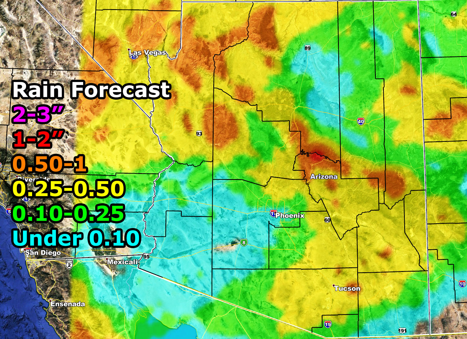
This is a simple forecast outlook. Not seeing anything major with this system while Southern California gets the most rain, which is actually more typical in the season. The image in this description ‘article’ shows you the AZWF rain forecast for between tonight and Thursday morning. Wednesday will have the most rain. This is a higher snow-level system so Flagstaff I’ll give you 1-3″ of snowfall.
Here are select rainfall zones –
Phoenix – 0.10″ south 0.25-0.50 north
Tucson – 0.50″ median
Payson – 1.00″ median
Prescott – 0.25″ median
The Grand Canyon – 0.50 – 1.00″
Kingman – Near 1.00″
The rest of you use the map in this write-up
NOTE: This is the SCWF Website but it is being used for national updates until a suitable national website can be developed for you.
Your Facebook Page to join for this update is linked here – https://www.facebook.com/ArizonaWeatherForce
Reading for another state? Find your region I serve here – https://www.facebook.com/nwfweather/photos/a.643550279121473/1544547759021716

