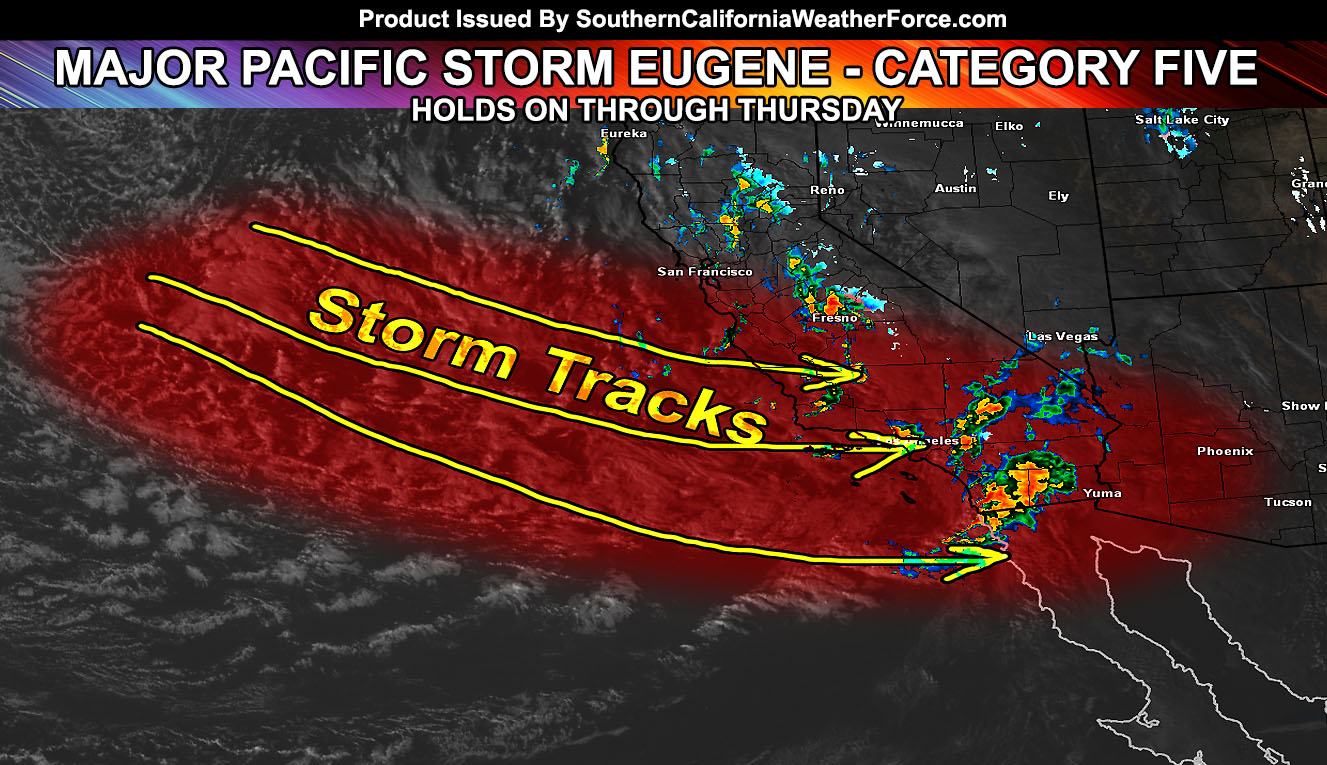
Major Pacific Storm EUGENE, a Category Five Pacific Storm, rocked some of the forecast area today, bringing tornadoes, damaging winds, flooding, and blizzards … and it continues through tonight. Find out where … We are now moving to the alert system for the evening if needed to focus on micro-climates.
First I will go into how this was forecast. I will provide you links to go to expressing what went into preparing this service for the storms that hit. On December 28, 2015 an article was published here at SCWF about the medium range pattern to come. Subscribers to premium services offered here got this on the 27th. Yes, I do charge a small season pass or yearly fee for some of these products, excluding all articles – which can be found free on the Facebook Page and over the app. To have this level of forecasting on a micro-climate scale comes with a price because it burns me out, literally I am the only person forecasting on this site and only have one server tech.
Many are subscribing to this and it boggles my mind exact how many are. You can get weather for free anywhere right? No, this service is a detailed assessment on what to expect when an event is in the area. You get what you pay for … and the subscribers enjoy the commodity of micro-climate forecasting.
Check it out yourself – https://www.southerncaliforniaweatherforce.com/system-sign-up/
Free Trial: Free Trial STORM PASS is available till tonight.
Link – https://www.southerncaliforniaweatherforce.com/trial-membership/
Pacific Storm Category System was developed with names to keep track of the storms that impact us. You remember the snow in the Inland Empire in December 2014? That was Freeman – And the only reason I know it is by name.
Link To Learn More About Categories – https://www.southerncaliforniaweatherforce.com/pacific-storm-category-system/
So the advisory was issued on the 27th, followed by the article on the 28th of December. It stated that the pattern confidence was high in a change to multiple storm systems in the area.
Link – https://www.southerncaliforniaweatherforce.com/2015/12/28/el-nino-values-plummet-series-of-storms-looking-more-possible-first-week-of-january/
So let’s focus on Eugene. Major Pacific Storm Eugene’s article update came out a day before it hit. The article stated right there that we would have severe thunderstorms and tornado risks being elevated, even with a nice shiny video forecast.
Link – https://www.southerncaliforniaweatherforce.com/2016/01/05/major-pacific-storm-eugene-announced-category-five-starting-wednesday-strongest-storm-in-10-years/
On January 6, 2015 I issued the Tornado Watch as confidence was high the first area would see it would be San Luis Obispo County. During the morning of January 6, 2015 a waterspout tore through Morro Bay. This went on to flip over a mobile home near Paso Robles. The Tornado Watch wording included that area, Santa Barbara, Ventura, Los Angeles, Orange, and San Diego County.
Link – https://www.southerncaliforniaweatherforce.com/2016/01/06/tornado-watch-2/
When I woke up at 8:15am to start work on the storm, I noticed that a weakening of the tornado dynamics through the Inland Empire would still produce severe storm activity, without the tornadoes. So I issued the Severe Thunderstorm Watch
Link – https://www.southerncaliforniaweatherforce.com/2016/01/06/severe-thunderstorm-watch-11/
Over the day, numerous strong areas of rotation hit Santa Barbara, Ventura, Los Angeles, Orange, and San Diego County. Most went without governmental warnings and I had to issue them over the app/email system myself. The only ones with warnings from the Governmental offices were in San Diego County.
Blizzard Warnings were issued in the morning stating Big Bear would see FEET of snow and as of 4:00pm they reported 18″ and it still is coming down. As is the top of San Jacinto.
Every time I issue something you will fast learn to heed these warnings. You may hear elsewhere I do not know what I am doing, creating hoaxes, etc … but that is far from it. Everything I say is because it will happen. Call it my time machine that I go into the future with and gather my weather information and then relay it back to you, because that’s what some have accused me of, can you believe that? You will not hear my reports on any other site. This is a private weather alert site and some information is shared freely to you. I don’t follow other reports, I make the reports custom so that you know these events can be forecast ahead of time.
For the rest of tonight I will outline the chance of a dusting in the Metro High Desert. I may issue a Winter Weather Advisory pending an area out in the ocean that may swoop in after midnight and toward sunrise. This would bring the region an uplift in shower/thunderstorm activity and if this comes over the Apple Valley/Hesperia/Cajon Pass/Victorville zones it would produce some snowfall there as well … but briefly.
For all other areas, there is no dry air behind this. The dry air usually accompanies the fronts and then we have nothing. However this is a very wide trough and we’re at the base of it. Dynamics and moisture will continue to stream through the rest of this evening and night, bringing shower and thunderstorm activity just about anywhere. If an organized area is seen, I’ll outline it … but for now this mention of it continuing through the morning tomorrow will be fine.
Friday we’ll have a break and then another system approaches on Saturday. At the moment it does not appear to be strong.
Those are subscribed to the STORM PASS will have those expire tomorrow. If you wish to continue your pass until March 1st you can check the page for that. It is recommended to go yearly so you don’t have to repay again on March 1st at full price. We’re running what is a partial pass attm.
View what is included in these passes – https://www.southerncaliforniaweatherforce.com/system-sign-up/

