[vc_row][vc_column][vc_column_text]
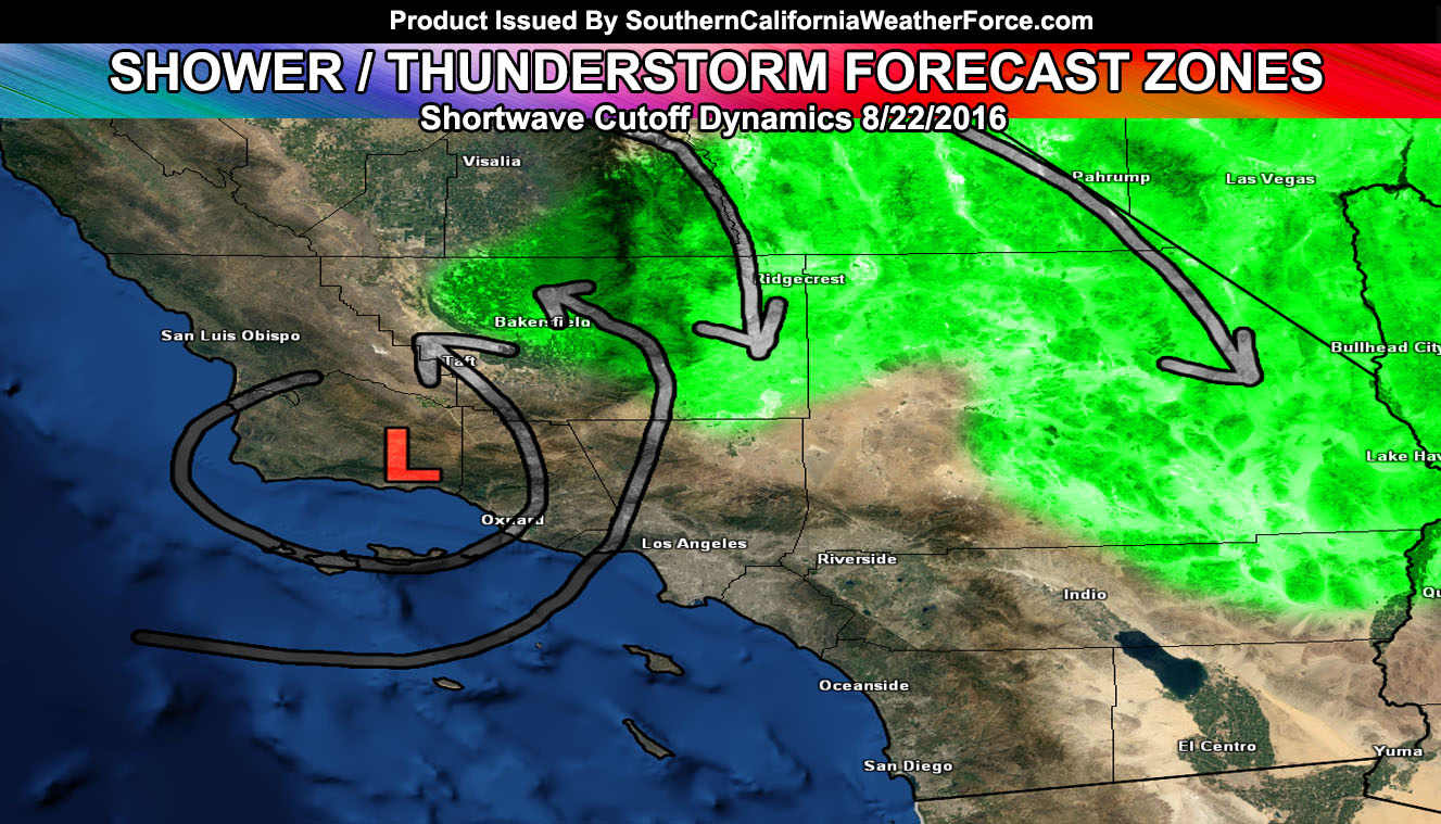
A shortwave cutoff low is expected to bring an increase in shower and thunderstorm dynamics for the Kern County areas east through the San Bernardino Desert zones and between Desert Center and Blythe. Read on for details …
A fast moving shortwave will move through the forecast area today from west to east … Upper divergence and instability with it will be available for the Kern Desert/Mountain zones .. but with the flow moving from east to west .. or southeast to northwest over the Kern areas today I’ll also introduce the risk of shower OR thunderstorm activity into the Bakersfield and surrounding valley zones today as well.
With the additional of the shortwave moving through … storms will also form in the San Bernardino Deserts stretching south into the Eastern Riverside Desert zones for Desert Center and Blythe. If at the river today you’ll encounter the strongest instability near Havasu and therefore the highest risk of severe storms.
Storm flow will generally be east to west over the Kern Mountain/Valley areas … north to south over the Kern Deserts … and west to east for the rest of the San Bernardino/Riverside Desert zones …[/vc_column_text][/vc_column][/vc_row][vc_row][vc_column][vc_facebook type=”button_count”][/vc_column][/vc_row]
