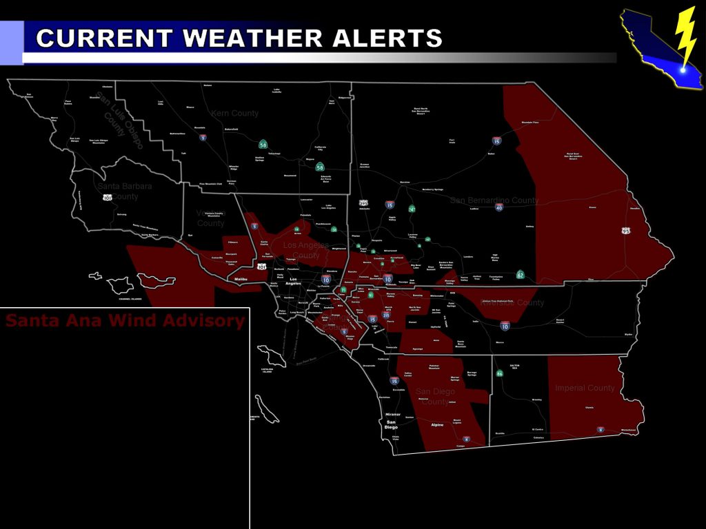
[vc_row][vc_column][vc_column_text] [/vc_column_text][vc_column_text]Issued Zones: Santa Clarita and Northern San Fernando Valley to Tujunga … Ventura Coast/Valley … The Inland Empire … Orange County minus northwest county and coasts … Morongo Valley … Aguanga … San Diego Mountains/Foothills … Banning Pass … San Bernardino Desert Needles Zone … Acton … Malibu .. .San Bernardino Mountain Southern Rim …
Authoritative Office: SouthernCaliforniaWeatherForce.com has issued a Santa Ana Wind Advisory effective now through Monday …
Issued Date: 12/17/16 at 9:45am Pacific Time
Forecast: Gradients will go offshore tonight and maximize Sunday morning across the area. Pretty good low level support on Sunday morning with cold air advection will bring 30-50 mph wind gusts to the advisory areas.
One thing to note is that mid/upper support (weak though) will be available Sunday evening/night into Monday … which may very be enough to up all area gusts around 10-20 mph stronger than they will be on Sunday morning. There are no fire concerns on this event given how much rain we received within the last week.
Winds will relax on Tuesday …
10 mile rule: These alerts issued on this site means that within your zone and 10 miles from you will see the event forecast for. You may or may not see the event but it means you are in the zone or 10 miles from where someone will.
Forecaster: KM[/vc_column_text][/vc_column][/vc_row][vc_row][vc_column][vc_column_text]
If this doesn\’t say “you like this” below then click the LIKE button if you thought this was good information! This helps spread the word by just ONE LIKE … Do it every time if you enjoy these … Thanks for helping!
[/vc_column_text][vc_facebook type=”button_count”][/vc_column][/vc_row][vc_row][vc_column][/vc_column][/vc_row]
