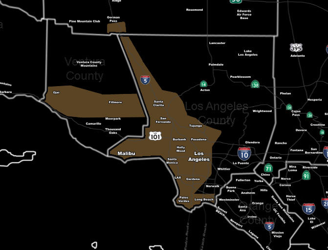
[vc_row][vc_column][vc_column_text] [/vc_column_text][vc_column_text]Issued Zones: SCV/SFV … Gorman Pass … Downtown Los Angeles to LAX/Palos Verde … Fillmore and Ojai …
Site: SouthernCaliforniaWeatherForce.com has issued a Wind Watch effective now for Wednesday night through Thursday morning …
Date: 2/20/17 at 4:40pm PT
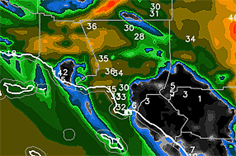
Forecast: A dry frontal zone will move through the area on Wednesday night into Thursday morning. Jet stream winds over 100 mph and mid/low level winds between 40-60 mph suggests that mid and low level support will be there for strong northwest winds out of the Gorman Pass, spreading southward into the SCV/SFV, Downtown LA, LAX, and Palos Verde zones then.
Going to go with wind gusts between 30 and 40 mph, with the higher gusts for the Ojai and Fillmore areas, nearest the Southern Ventura Mountain zones. These winds should last all night … some could bring minor damage, especially if they are weaker than my model shows … An upgrade to advisory or warning will be determined on Tuesday evening …

10 mile rule: These alerts issued on this site means that within your zone and 10 miles from you will see the event forecast for. You may or may not see the event but it means you are in the zone or 10 miles from where someone will.
Forecaster: KM[/vc_column_text][/vc_column][/vc_row][vc_row][vc_column][vc_column_text]
If this doesn\’t say “you like this” below then click the LIKE button if you thought this was good information! This helps spread the word by just ONE LIKE … Do it every time if you enjoy these … Thanks for helping!
[/vc_column_text][vc_facebook type=”button_count”][/vc_column][/vc_row][vc_row][vc_column][/vc_column][/vc_row]
