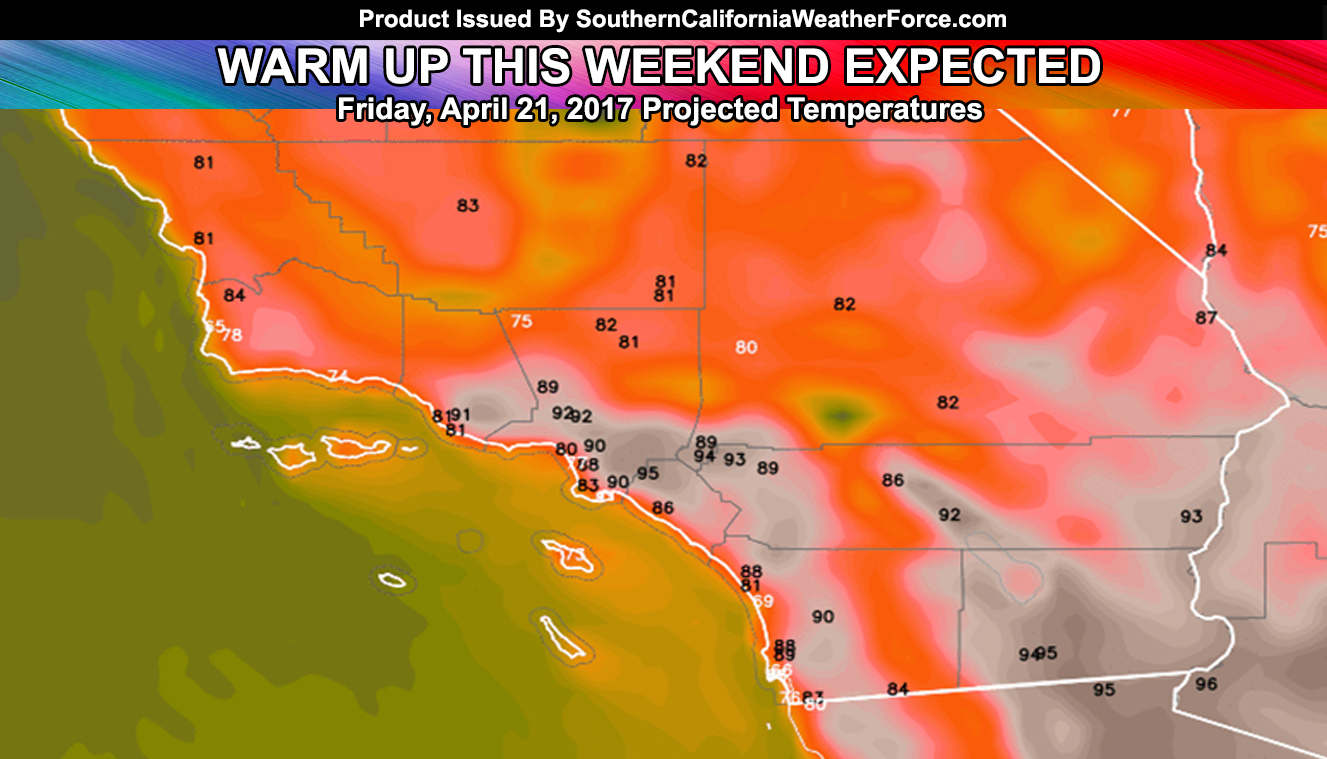
Except for the immediate coast, a warm-up is expected across the Southern California areas starting Friday and lasting into the weekend so read on for details.
An offshore flow will start across the Santa Barbara County areas in the form of a sundowner wind tonight. This sundowner wind signals high pressure to the north of the forecast area. The north to south flow will help generate sinking air across the Basins through there, Ventura, Los Angeles, Orange, and the Inland Empire areas through Friday … then in the form of the northeast flowing Santa Ana Winds.
Projections are that the basins will be in the 90s with this … the hottest day being Saturday with some areas just shy of the triple digit mark. The area that will be the hottest will be the Brawley forecast areas, where 100F+ is possible for your Saturday.
Long range hasn’t been too good lately because of the Spring Season, where the jet is transforming into the Summer phase and long range is very tough to predict. So while it may show nothing through the first week of May, with continued warm temperatures … this could flip-flop so until Summer hits … your guess is as good as mine.

