[vc_row][vc_column][vc_column_text]
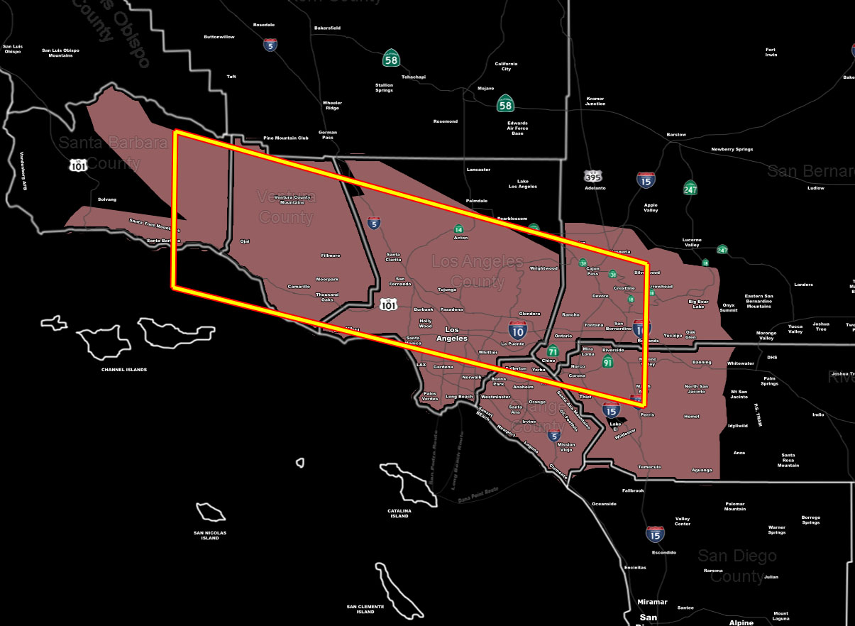
[/vc_column_text][vc_column_text]Issued Zones: The Inland Empire … Orange County … Los Angeles Basin/Coast/Mountain/Valley areas .. .Ventura Valley/Coast… Santa Barbara Coast to Santa Ynez …
Site: SouthernCaliforniaWeatherForce.com has issued a Thunderstorm Watch effective Tuesday …
Date: 7/31/17 at 7:30pm PT
Forecast: Upper level divergence will come into the area on Tuesday morning, starting before sunrise and quickly developing and pusting westward through the watch area, especially the box … which the best activity might be along the Cajon Pass , LA Basin/Mountains … and Ventura/SBA areas … Thunderstorms will contain lightning (duh) … downpours … and ahead of them dry lightning … In all reality just know thunderstorms might freakin’ form in your area … 😉
Storms will re-fire over the areas on Tuesday PM
10 mile rule: These alerts issued on this site means that within your zone and 10 miles from you will see the event forecast for. You may or may not see the event but it means you are in the zone or 10 miles from where someone will.
Forecaster: KM[/vc_column_text][/vc_column][/vc_row][vc_row][vc_column][vc_column_text]
If this doesn\’t say “you like this” below then click the LIKE button if you thought this was good information! This helps spread the word by just ONE LIKE … Do it every time if you enjoy these … Thanks for helping!
[/vc_column_text][vc_facebook type=”button_count”][/vc_column][/vc_row][vc_row][vc_column][/vc_column][/vc_row]
