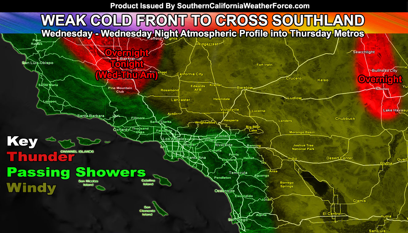
A cold front is going to zoom across our forecast region tonight into Thursday morning, bringing with it passing showers, gusty mountain and desert winds, and thunderstorms in the Kern Valley areas. Read on for details.
The upper level low that backed into the Martin Storm Diamond earlier in the week has finally kicked toward the east and ready to cross our area tonight into tomorrow (Thursday) morning. The system will have strong upper divergence profiles across two parts of the area, along with adaqute deep-layer moisture for thunderstorms. Those areas are the Kern Valley zones and the Colorado River Valley around the city of Needles.
LIKE ME ON FACEBOOK for updates! Click Here and join thousands …
Sometime after sunset is the best time for this and even without the Sun heating the lower atmosphere, these storms will develop. Going to go with after sunset and lasting for most of the night, especially in the Kern Valley areas. The upper level low will cross directly overhead there and produce a small, but compact area of upper divergence for strong lifting. This, combined with the deep-layer moisture and cold core instability of the system will pop off those thunderstorms, some could be strong.
In our metro areas however … the forecast still stands for passing showers tonight and into Thursday with the passage of the main cold front. The best chances will be like the Pacific Storm Season .. so this is for passing showers. I’d say almost 80-90% of the LA/OC/SD/IE regions will see them, with more isolated amounts around Santa Barbara and Ventura due to the lack of southerly flow. Still, a relief from the heat during the day and night will be felt by all from this system.
In the mountain and desert regions starting today and lasting through the end of the week you will have mainly wind … as is common for a Pacific Storm type pattern with the upper level system overhead. Advisories will go out soon.
We have a nice few days and then we warm back up. I’m not seeing terribly high temperatures this weekend, however there are indications of a Santa Ana Wind flow with higher temperatures towards the end of the month so this is what I’ll certainly be watching.
Stay tuned to Southern California Weather Force for updates …
Click Here To Find Your Zone On Facebook For Updates Now and In The Future
Click Here To Find Me On TWITTER.
VISIT THE MEMBER SECTION FOR 2017-2018 SEASON – SIGN-UP OR READ ABOUT IT HERE

