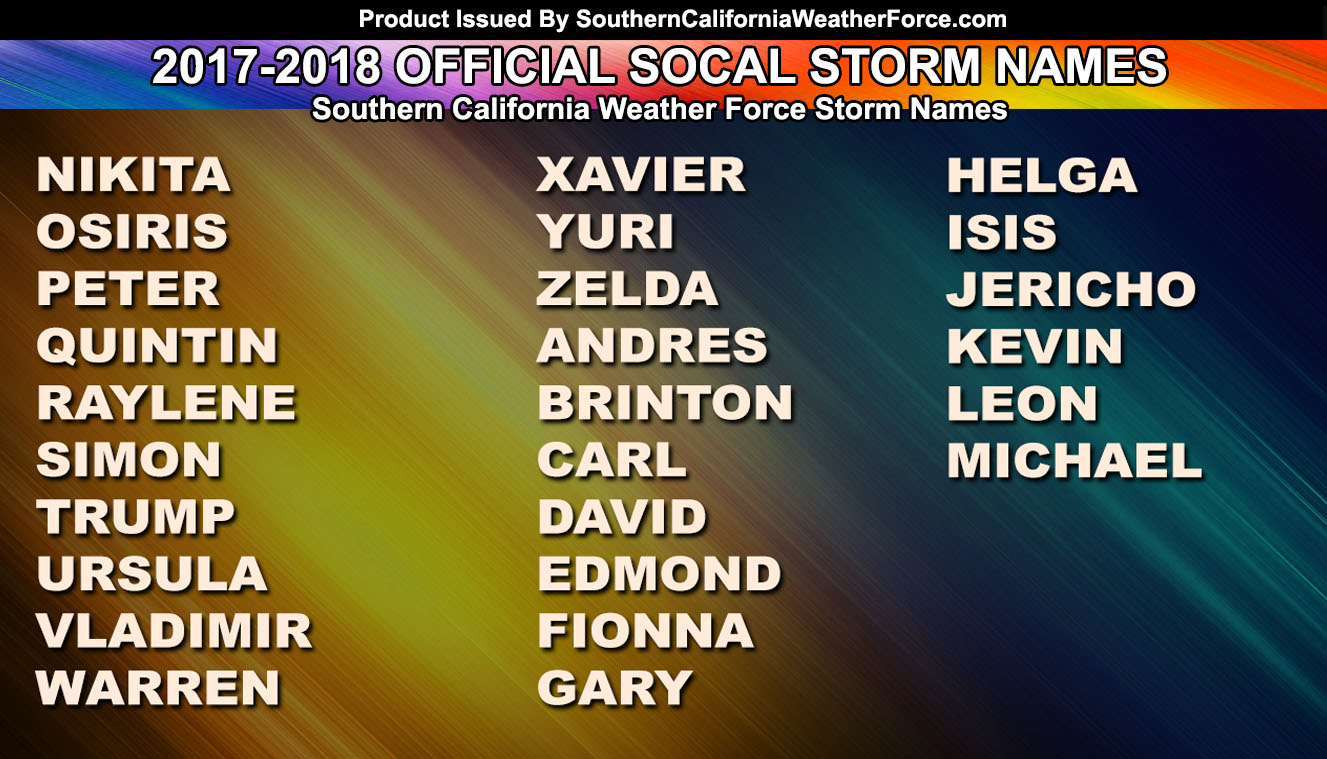
 The Southern California Weather Force 2017-2018 Pacific Storm names are in, a weak cold front this week, and then a warm-up with offshore flow by the weekend. Read on for all those details …
Every September when monsoon season ends the Pacific Storm name list is released. This is the first time I will continue with last season’s list where we left off, however this is the best thing to do so all names are used from A-Z as we likely will never see 26 strong name storms in a single season here in Southern California.
I have been name storm systems since before the year 2000. Back then I called them Winter Storms. However several years back I acquired Pacific Storm instead due to them happening in the Fall, Winter, and Spring. Famous names have spread across the news from my work, including last year’s Major Pacific Storm Hillary and Major Pacific Storm Lucifer, each becoming very popular in our area.
LIKE ME ON FACEBOOK for updates! Click Here and join thousands …
Southern California Weather Force also has adopted a category system. The category system is based off rain/snow intensity, thunderstorm coverage and type, and wind gusts along the main frontal zone. This three part system determines the storm’s category number. Category one does not have a name. Category two and three have Pacific Storm before the name. Category four, five, and six are designated Major Pacific Storms. Category four happens yearly while category five can happen once every one or two years on average. A few years back I added Category Six and we have not seen a category six since I added it. Category Six systems will happen every five to ten years on average. Could this be our year for it? Major Pacific Storm Lucifer was a Category Five.
Now onto the rest of the week …
A cold front will move through the region on Thursday, giving mainly the metros a deeper low cloud deck, drizzle, or light rain. This is similar to the last system where not everyone would see the precipitation and the best areas remain on the foothills of the south and west facing slopes of the mountains.
The real change comes back this weekend. After all of us are enjoying the taste of middle fall we will jump right back to near triple digits in the metros by Sunday into Monday. This is due to an offshore Santa Ana Wind type condition where the offshore winds sink off the mountain slopes and they heat up as they do. Fire hazards will be elevated during that time. I am not seeing a major Santa Ana Wind event yet, just a weak/moderate offshore flow. The heat will make it to all coasts then so expect above normal temperatures for a brief bit of time.
My numbers are indicating a warm start to October and premium members will get the first look coming up on September 25th.
Click Here To Find Your Zone On Facebook For Updates Now and In The Future
Click Here To Find Me On TWITTER.
VISIT THE MEMBER SECTION FOR 2017-2018 SEASON – SIGN-UP OR READ ABOUT IT HERE
