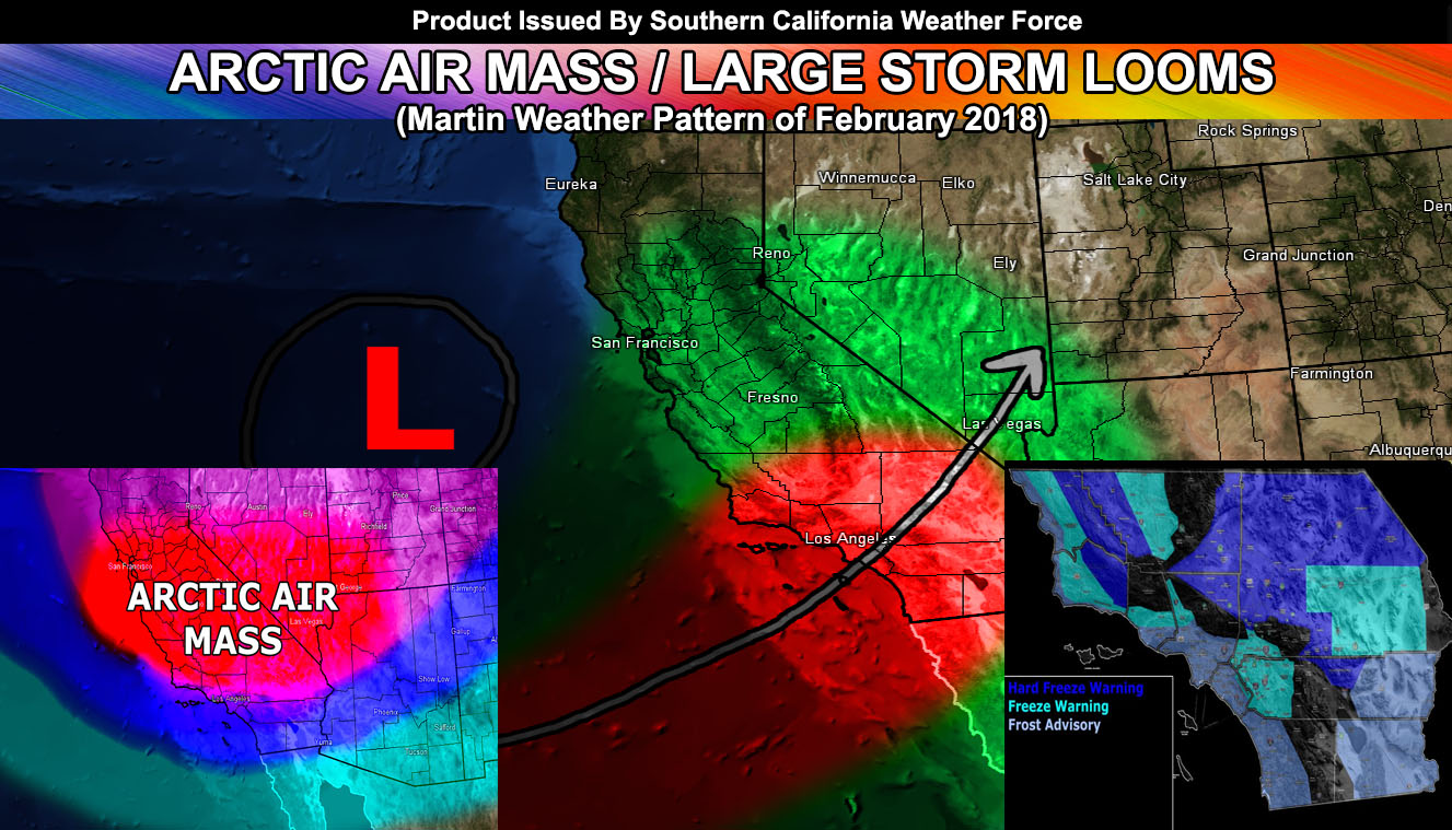
The Martin Weather Pattern of February 2018 is kicking off with the arctic air-mass over the region with numerous warnings out here at the office. A large storm system is in the long range and numbers remain high with it. Read on for more details …
It is a cold one for our standards today and tonight will be no exception. I’ve issued three alerts on the website to various areas, under cold alerts … but can air them here.
If in the freeze/frost zones, protect your plants if you have this hobby or job.
NOTE, that in the freeze warning zones you will run into black ice in the rural locations.
Hard Freeze Warning – 26F and below
Kern/SLO Border … High Desert … Morongo Basin … JTNP …
Freeze Warning – 32F and below
Inland Empire … SCV … Upper VT Basin … Inner SBA and SLO Valleys … 29 Palms Base …
Frost Advisory – 33F to 38F
San Diego Coast/Valley … Orange County … Los Angeles Coast/Basin/SGV/SFV … Ventura southern basin to coast … Santa Barbara and SLO Coast … Imperial Desert … Desert Center to Blythe …
Snow was reported in Yucaipa and Banning/Beaumont today just after my Short Term Forecast for it was released so we can chalk that down as a hit at that snow-level.
Given what we are seeing right now we have another similar system on the pipe-line, delivering yet another arctic air-mass to the region later this week. This one looks like it will bring better rainfall chances to the region … and yet again with the lower snow-levels like the current system over us now. Snow levels as low as 2,300 FT being reported over the Inland Empire today. The system by the end of the week will be a bit closer than the current one and thus may introduce a risk of thunderstorms in some of the forecast area. Where right now is not certain and it will depend how far southwest it will come … it is after-all still going to be considered an inside slider.
The long range values in the member section continue to show a low to mod confidence in 1″ or higher precipitation in Los Angeles toward the end of the month along with a 100% confidence in a storm hitting around then. This long range projection is the same projection in the forecast back on January 20th for February to have Alaskan Storms dipping down into the region. A true Alaskan storm like this would deliver heavy snowfall to the mountain resorts before this month is over.
As we go into March we continue with this pattern… as it will turn into the Martin Weather Pattern of March 2018 since both patterns are merging. This is a prolonged period of unsettled weather coming up …
Stay tuned to Southern California Weather Force for the latest official information … and members … continue to check the member section for the latest updates.
This is the end of the public article …
This is now members only and subscriptions can be looked into on the following link – https://www.southerncaliforniaweatherforce.com/system-sign-up/

