Welcome back! Well at least I’m 90% there after a major computer crash but all my algorithms have been redeveloped over the last week or so and here is your July 2019 Forecast.
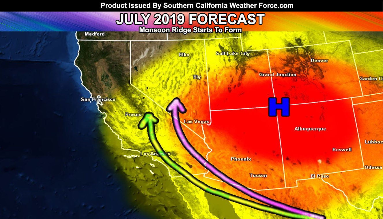
Given what I see, the weather is going to get hotter and more normal for the region this month as after the 4th we will start to see the four-corners monsoon ridge build. The monsoon ridge is an area of high pressure over the four corners (Arizona, New Mexico, Utah, and Colorado) that forms as the upper level jet stream from the storm season starts to relax and move north toward Canada. This allows for a calm in the atmosphere and the ridge forms as a result. The upper winds do shift from west to east so instead of getting storms off the coast, we get them out of Mexico and Arizona. So what about this month? Well, my long range a couple months ago mentioned mid-July would be when we see the ridge take shape and this looks very likely.
Sometime after the 8th or so is when we will see a kink in the ridge as they do happen upon collapse and formation of the ridge. These ‘kinks’ are called easterly waves and these waves contain upper dynamics for lift and groups of moisture for storms to feed on. The ridge-axis for these are hotter temperatures will be available by mid-month. The graphic I used in this article is the exact same as the previous post as there is no change in thought.
As the ridge-axis does come over, I do believe we will have mainly above average temperatures for the deserts and Bakersfield, average for the metros with slightly above average inland, and below average in the Vandenberg to San Luis Obispo areas. Rainfall seems to be a toss-up of average across the region.
The El Nino Status does indicate we are at a Weak El Nino and such El Ninos after a Moderate for the Summer have given surprise July and August events so my eyes will be open for updates in the future. Happy 4th of July to you and this GREAT Country …
Oh, and if you have recently signed up for the e-mail alert system I will get to you by the evening as I re-establish contact with my e-mail accounts. My operations have been down for awhile now due to the major crash. Ponder This science show returns by Monday of next week …
As always, stay tuned to official forecasts from Southern California Weather Force for updates …
For The Main Weather Facebook Page Click Here and Join.
End Article
OPTIONAL: Southern California Weather Force main page now has models, agendas, the alert map, and other things updated during storm events. You can bookmark the main site and check back during an event for the latest updates.
Click here to view the main page
EMAIL ALERTS AND ASK THE WEATHER OFFICE A QUESTION: It pays for itself in one storm system. A very affordable e-mail alert system that only gives you SCWF weather alerts in YOUR micro-climate area. Also, you can ask the weather office a question at any time if you get that add-on.
Click here to join
MICRO-CLIMATE ALERT FACEBOOK GROUPS: Find yours today!
Click here to join
FACEBOOK PAGES TO JOIN!
SOUTHERN CALIFORNIA WEATHER FORCE MAIN: if it does not say “Liked” LIKE The Page Below and join thousands of informed weather forecast viewers in our region for more of the updates! noticeable
BEHIND THE SCENES FORECASTS/UPDATE PAGE: if it does not say “Liked” LIKE The Page Below and join thousands of informed weather forecast viewers in our region for more of the updates! noticeable
FOR THE CALIFORNIA FAULT STRESS MODEL PAGE: if it does not say “Liked” LIKE The Page Below and join the official page to the California Fault Stress Model
INSTAGRAM AND TWITTER ACCOUNTS TO JOIN!
Instagram – https://www.instagram.com/socalweatherforce/
Twitter – https://twitter.com/SCweatherforce

