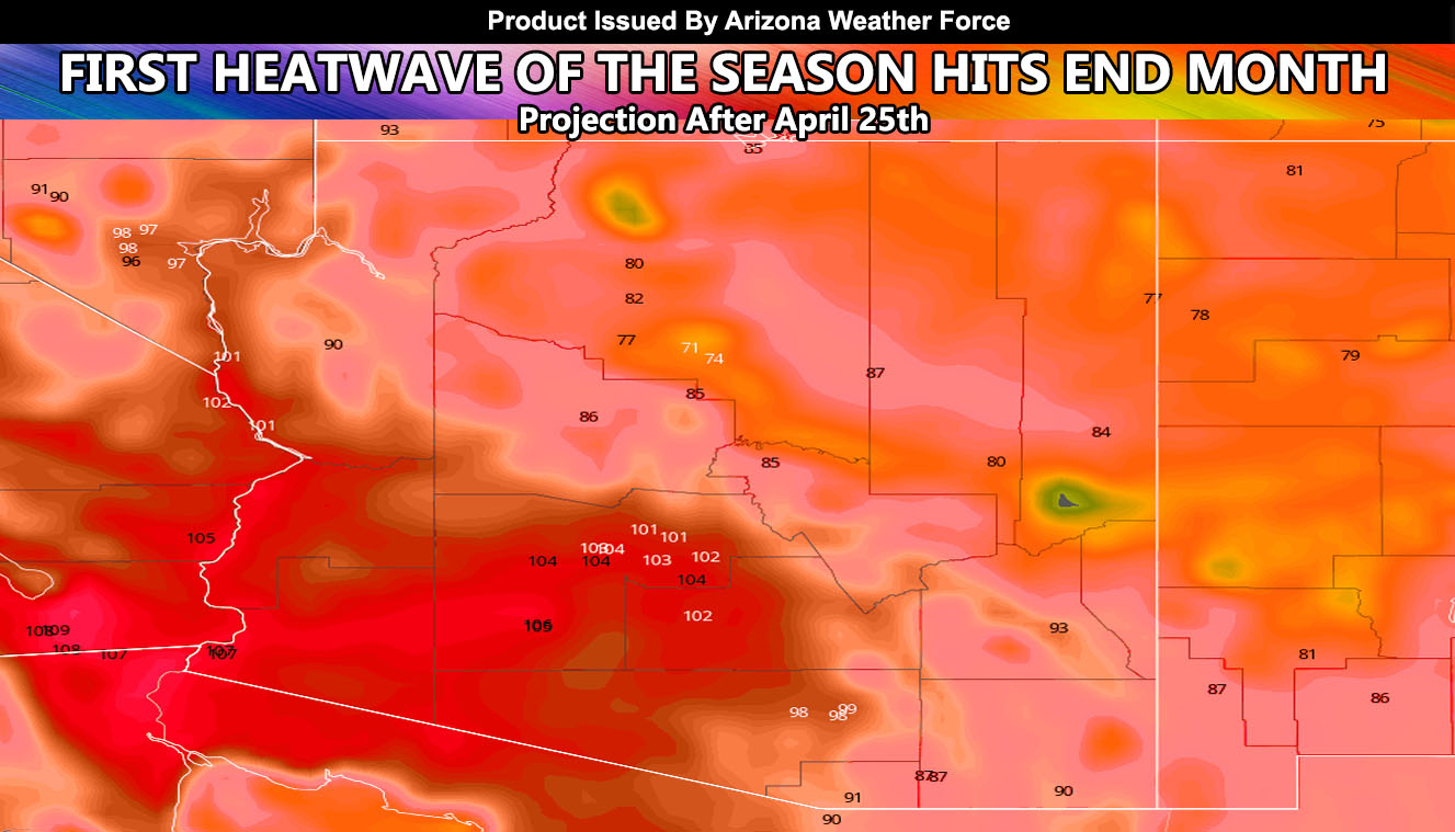
The first heatwave of the season will strike starting this end week into the weekend so a good week from now. The heatwave will continue to build in strength through early week (April 26th onward through the end of the month as a ridge of high pressure remains static over the area. This is your ‘see-saw’ pattern I discussed would happen this month. We had the rain and cold and now we switch to the heat.
Some of you are welcoming of the heat but if you are inland I would advise to make sure your air conditioning is up to par before it hits. Due to so many people being home and out of work, it will be a tough start to the Spring 2020 heatwave season. Temperatures are expected to be in the 100s for the inland metro zones with temperatures between 105-110 for the Colorado River Valley. This is your first major heatwave on a norm you are use to.
My preliminary Summer forecast is for average temperatures for the start with above for the mid/end season so we may actually be looking at an above average Summer in terms of temperatures, which means a lot of heat to contend with, which is opposite of what I called for last Summer and we did indeed end up cooler than average. I will continue to monitor super long range values as we move through May and look into the Arizona Monsoon as well. Right now we are looking average.
As you know, just as Southern California Weather Force has a service for members with micro-climate alerts, Arizona Weather Force does as well and we do have some people already signed up getting those so it is seeming like it is helping. The service helps businesses and persons, especially with ranches. Click Here to read about it and even join.
NOTE: This is the SCWF Website but it is being used for national updates until ad placement is ready on the AZWF site.
Your Facebook Page to join for this update is linked here – https://www.facebook.com/ArizonaWeatherForce

