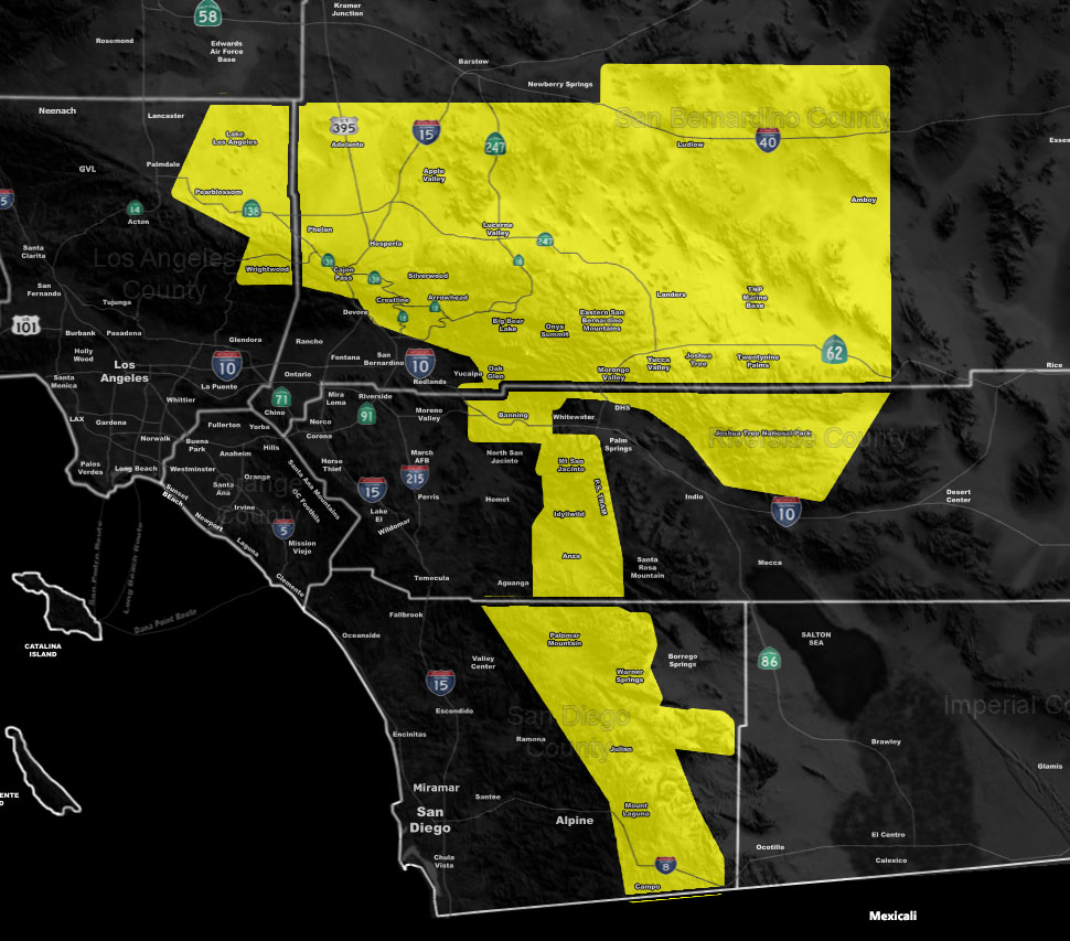
Issued Zones: San Diego, RIverside, San Bernardino, Los Angeles Mountains … Metro High Desert and Morongo Basin …
Site: Southern California Weather Force has issued a Severe Thunderstorm Watch effective now through this evening …
Date: 8/19/20 at 8:00am PT
Forecast: An area of vorticity coming through the Morongo Basin this morning will pull northward over the day as the ridge migrates. This should allow dry air advection behind it and now my thoughts are it will lessen the debris clouds and push up instability in the watch area. Large hail and damaging downburst winds will be likely in the watch zones through the evening … Some flooding my happen with the strongest storms, but the bases will be high today so this is a damaging wind/large hail event where cells cross …
NOTE: I am NOT allowing new sign-ups paying for the SCWF alert system at this time. I am redoing the system over the Summer and offering free service till October 1st. This is because this Summer is either close… or keep open come the next storm season due to a post COVID-19 economy. You can grab the account here – https://www.southerncaliforniaweatherforce.com/trial-member/
Join A Micro-Climate Group On Facebook For These Alerts? (50 percent delivery time)
Click Here To Find Your Location Served By SCWF Today!
NOTE: If you read this from a SCWF micro-climate Facebook Group, keep in mind that forecast ARTICLES are NOT posted there unless it directly affects you. You will want to go to the MAIN SCWF Facebook Page and to go there you CLICK HERE.
10 mile rule: These alerts issued on this site means that within your zone and 10 miles from you will see the event forecast for. You may or may not see the event but it means you are in the zone or 10 miles from where someone will.
Forecaster: KM
