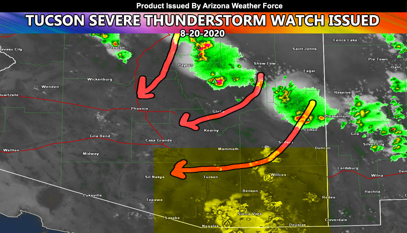
Arizona Weather Force has issued a Severe Thunderstorm Watch for Southeast and Southern Arizona, including the Tucson area and a Weather Advisory for the Phoenix Valley effective this evening into the night …Read on for details ….
Thunderstorms are have formed on the Rim and the general flow is out of the north and east. It’s not too fast, but the down-sloping from the stronger storms could bring outflow boundaries down into the Phoenix and Tucson areas this evening. That is the focus …
If I had to call it now, it would be a 40% coverage of storms in the Phoenix Valley areas, meaning 60% of you won’t have it … and a 90% coverage for the Tucson areas, meaning most of you in Tucson will get the storms this evening …
So more in Tucson by far than in Phoenix. Outflow will come directly down I-17 into the PHX area and pop storms there while numerous cells are expected to form and hit the Tucson area. Storms will have a marginal severe wind risk and due to strong upper divergence on the SE side of the high pressure system, storms may very well go into the night …
K.MARTIN
Senior Meteorologist – ⚡️🇺🇸 – is a consulting meteorologist for over 50 different companies, including large oil companies like BP. He has certs from MSU and PSU as a broadcast meteorologist. Both short and long range is very important to know in those jobs so you can bet on accuracy here.
Stay tuned to official forecasts here at Arizona Weather Force
As you know, just as Southern California Weather Force has a service for members with micro-climate alerts, Arizona Weather Force does as well and we do have some people already signed up getting those so it is seeming like it is helping. The service helps businesses and persons, especially with ranches. Click Here to read about it and even join.
NOTE: This is the SCWF Website but it is being used for national updates until ad placement is ready on the AZWF site.
Your Facebook Page to join for this update is linked here – https://www.facebook.com/ArizonaWeatherForce

