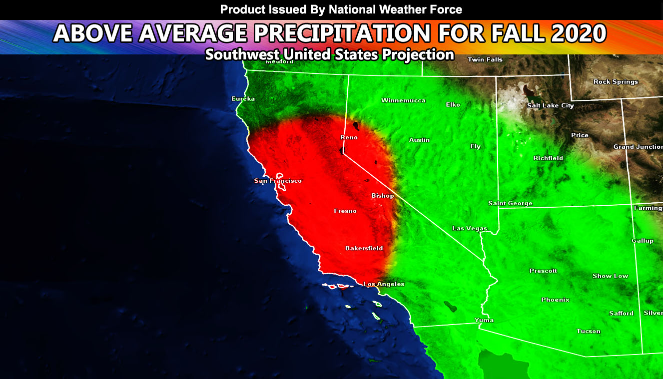
For Immediate Press Release – (National Weather Force) – Patterns in the atmosphere are suggesting we will run into an active October, November, and December across the Southwestern United States with above average precipitation so read on for details …
La Nina will be in full swing this Fall and many think La Nina means dry conditions. You are right, it sometimes does, but other times it does not. Active Fall seasons are common with drier winter seasons during La Nina. I’m not sold on issuing a winter forecast right now but what I am sold on is a pattern where strong ridges (heatwaves) break down into strong low pressure systems dropping down into the area. Usually in the Fall we see a flatter neutral pattern with the jet stream riding almost zonal into the Pacific Northwest and down into the Central USA, missing the Desert Southwest. This Fall however, an amplified pattern will make for a ridge shoving east and allowing for these low pressure systems to move in.
THE HINT: There are times El Nino and La Nina do not match what can happen. The angle of the hurricane heading for Japan indicates a ‘wrench’ in the system effect. If you know the butterfly effect a butterfly’s wings can create a small amount of air current that ‘can’ affect an area nearby. Same thing happens with hurricanes. If they are not suppose to be in the normal jet stream flow then the entire system goes haywire and changes from what could have been. This such hurricane will cause a butterfly effect for the Southwestern United States.
FIRE RISKS: They will be there this season between ridges and storms, but the thing I am most concerned about is how many fires we have seen across California and Arizona. These large complexes will cause a flood issue and we may very well have a catastrophic flood hazard on our hands. So despite La Nina being predicted, I suggest you get sandbags stocked if you are in an area that would need them and make sure flood insurance is up to date.
We should go through most of September without a major rain incident.. but when October moves along we will start to see these systems dropping in and December till the 21st is still considered Fall so it should be active then as well. Heck… we can go October/November drier than normal and GET SLAMMED in December … Regardless, I do believe between October 1st and December 21st we will have a southwest flooding episode.
Facebook Pages On Network To Follow, Choose Yours If You Haven’t Already –
National Weather Force – https://www.facebook.com/nwfweather/
Southern California Weather Force – https://www.facebook.com/scweatherforce/
Arizona Weather Force – https://www.facebook.com/ArizonaWeatherForce/
California Fault Stress Model – https://www.facebook.com/CaliforniaFaultStressModel/

