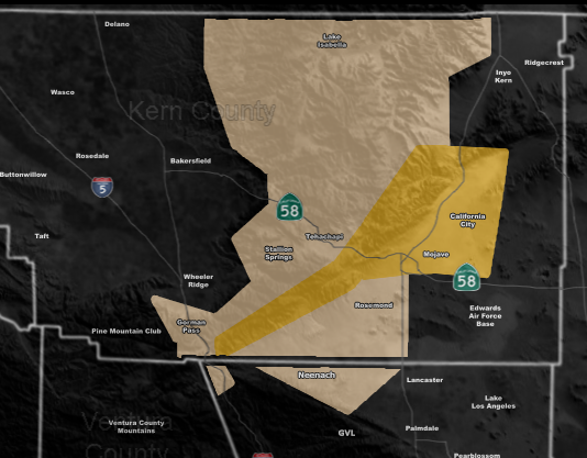
Issued Zones: Kern County Mountains … Mojave, Rosemond, and Neenach …
Site: Southern California Weather Force has issued a Wind Advisory and High Wind Warning Hybrid Effective Monday morning through Monday evening …
Date: 11/22/20 at 11:30am PT
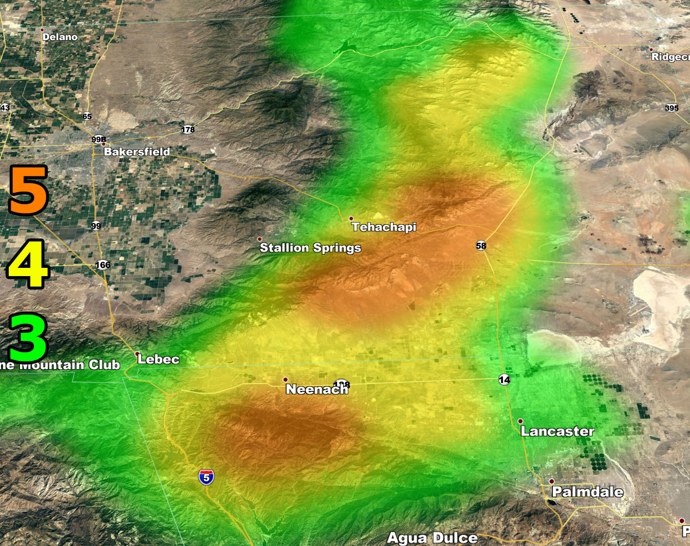
Forecast: A dry front will move through the region overnight tonight, increasing the west winds across the forecast area by Monday morning, moving along throughout the day and into the evening … where they will drop off overnight on Monday … Use the map above and below to find out what zone you are in … The High Wind Warning above is the smaller orange zone …
5. Slight damage occurs to buildings, shingles are blown off of roofs. HIGH WIND WARNING CRITERIA – High Profile Vehicle Roll-Over Possible if weight is not corrected.
4. Twigs and small branches are broken from trees, walking is difficult. Anything 4 and above will have blowing dust if conditions are dry, which does reduce visibility and make driving difficult …
3. Large trees sway, becoming difficult to walk. POWER SHUTDOWN THRESHOLD during any high fire risk. WIND ADVISORY CRITERIA
Remember, you CAN get these by e-mail with discounts as a supporter as well. Find Southern California Weather Force in this link to learn how – https://www.southerncaliforniaweatherforce.com/weather-force-network-2020-2021-public-fundraiser-and-perks-page/ (100 percent delivery time)
Join A Micro-Climate Group On Facebook For These Alerts? (50 percent delivery time)
Click Here To Find Your Location Served By SCWF Today!
NOTE: If you read this from a SCWF micro-climate Facebook Group, keep in mind that forecast ARTICLES are NOT posted there unless it directly affects you. You will want to go to the MAIN SCWF Facebook Page and to go there you CLICK HERE.
10 mile rule: These alerts issued on this site means that within your zone and 10 miles from you will see the event forecast for. You may or may not see the event but it means you are in the zone or 10 miles from where someone will.
Forecaster: KM

