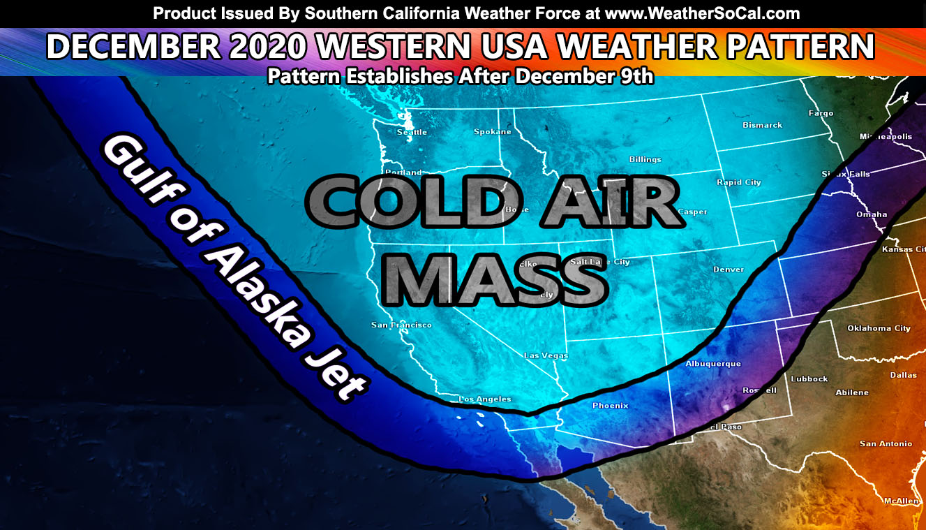
December 1st marks meteorological winter’s start and you can think of it as June 1st where the transition to summer then (winter for this) is going to take place. Long-range numbers indicate that we will have a cold trough in the Western United States so read on for details …
Long-range numbers indicate that the first week of December will be ruled by a Santa Ana Wind Pattern. This watch is already out and has been in the numbers since November 27th. You can click here for that article. As we move along to December 9th, my long-range calculations indicate a ridge developing in the Eastern United States that will last the entire month on average. This means that a trough will be introduced to the Western United States for cold air and storms coming down from the Gulf of Alaska. This type of setup is not normal during La Nina. So what will happen is the month of December will be below average in temperatures with many cold shots moving on through.
The month has the characteristics in the atmosphere to produce storms in the region, some of them being highly active. It also has the dynamics for strong Santa Ana Wind Events as well. It will be a mixed bag month. So far, the November forecast for Central USA tornado setups is going as predicted. This means that we will see an upswing in storm activity here as we move through early 2021 especially. My numbers do indicate the atmosphere will be capable of numerous tornado setups across Southern California between December and May. Here at Southern California Weather Force, I am fully capable of predicting those events when they are coming, due to having developed a tornado forecast model for this area. Tornadoes do happen here more than you think. The coastal areas have waterspouts that come ashore as tornadoes and the basins are flat enough for a further breeding ground. This season should have a number of storms capable of tornadoes.
CHRISTMAS WILL FEEL LIKE CHRISTMAS TEMPERATURE-WISE
Many of you are wondering when the major rains have the best chance at coming. Well, think of Summer. What months have the best chance of summer heat? July and August do. They are the seventh and eighth months. Add 6 months to each and you get January and February as the equal to those months but in the dead of winter. January and February are typically the wettest months of winter in Southern California for storms just as July and August hold the hottest months of summer.
REMEMBER: Get these from the new app for notification – National Weather Force Android/IOS App notification system and you can find it here for free and never miss a post on this page again,
Download Today at – http://www.nationalweatherforce.com/2020/07/fb-weather-phone-app/
Southern California Weather Force is NOW on MeWe – https://mewe.com/p/southerncaliforniaweatherforce
As always, stay tuned to Southern California Weather Force for official forecasts and updates on weather across Southern California
Join Southern California Weather Force main Facebook Page for future updates!
MICRO-CLIMATE ALERT FACEBOOK GROUPS: Find yours today!
Click here to join
Reading for another state? Join my national page – https://www.facebook.com/nwfweather/
FACEBOOK PAGES TO JOIN!
SOUTHERN CALIFORNIA WEATHER FORCE MAIN: Southern California Weather Force Office Main Page
NEWS REPORT BANDIT: Tired of Politics and Celebrities and want funny, interesting, weird stories, including science like solar storm, earthquake, volcano, space stories updated 1-2 times a day?
FOR THE CALIFORNIA FAULT STRESS MODEL PAGE: For SCWF official updates to the California Fault Stress Model and more!
PROJECT DESTINI WORLDWIDE QUAKE PREDICTION – A system that shows worldwide plate stress due to numerous factors
INSTAGRAM, TWITTER, and NOW MEWE ACCOUNTS TO JOIN!
Instagram – https://www.instagram.com/socalweatherforce/
Twitter – https://twitter.com/SCweatherforce

