As stated in the previous article on March 18th, the long range would have another system move in with the storm pattern around March 28th and that would make this the second outlook as this looks to be a major storm system so read on for details …
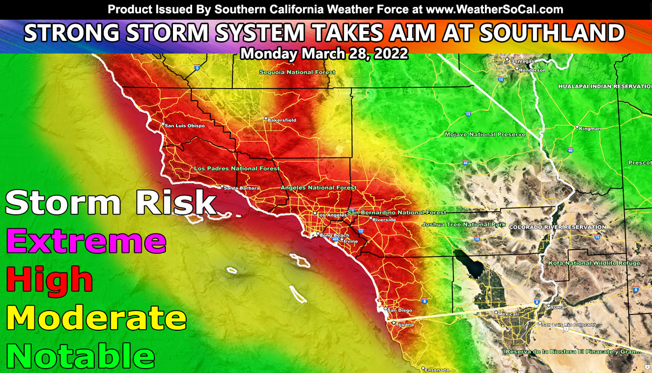
In what will be the strongest storm system since the December storm systems this season, this will start at a category four out of six, which makes this officially a Major Pacific Storm on the Southern California Weather Force storm scale. This system is due into the area on Monday, March 28th, 2022 with heavy precipitation along what looks like two frontal zone. The first front would be the surface front and the second one will be right behind it, which looks like it can harbor the cold front, or the main dynamics for thunderstorm risks to go up.
The graphic above is the SCWF storm risk model for precipitation where the high risk value is usually a category four. Should this have stronger thunderstorm dynamics, we could see an upgrade to category five. If you are the person that is golfing in San Diego at a tournament or something you said in the Facebook Page comment section, this was warned about so sorry about the game.
This system is a warmer type system with tropical moisture. This means that the overall snow-level will be on the higher side, possibly over most of the resorts with little to no accumulation.
Updates will be made to this system as it nears through the weekend for the Monday impact. Would suggest getting sandbags ready in-case you need them in the higher risk area …
How to get these alerts with a premium subscription via e-mail by micro-climate zone AND/OR Get the GPS models for all events on your device enabled? (100 percent delivery time)
Click Here To Join The Season Tier
Join The Main Southern California Weather Force Facebook Group (50 percent delivery time) – You can join the main SCWF page as well through that group.
Click Here To Join The Page Today
FACEBOOK PAGES TO JOIN!
SOUTHERN CALIFORNIA WEATHER FORCE MAIN: Southern California Weather Force Office Main Page
SOUTHERN CALIFORNIA WEATHER FORCE METEOROLOGIST: – Just my public figure page that isn’t as large so maybe you can reach me better at times.
INSTAGRAM, TWITTER, TO JOIN!
Instagram – https://www.instagram.com/socalweatherforce/
Twitter – https://twitter.com/SCweatherforce
Southern California Weather Force is a custom weather alert service that began in September 1999 off and is regarded as the most accurate weather service in the region, offering custom alerts, maps, and models to help save life and property. The work done here is never 100% accurate, but it comes pretty close. Southern California Weather Force runs on zones, so if an event happens in a zone that is 10 miles from the border of your zone, the forecast is still valid to activate your zone’s alert system. A company quote to the public is that of “The Joker” and tells other agencies in weather this all the time… “This world deserves a better class of meteorologist… and I’m gonna give it to them”… out-forecasting even the National Weather Service with lead-time and precision, which makes this service a focus of ridicule and envy in the weather community due to having such accuracy. Alerts issued here are issued custom from this office and this office alone. You may not even hear it elsewhere, but if one is issued near or in your area, listen up because “if you do not wish to die in weather, follow, it’ll save your life one day.”

