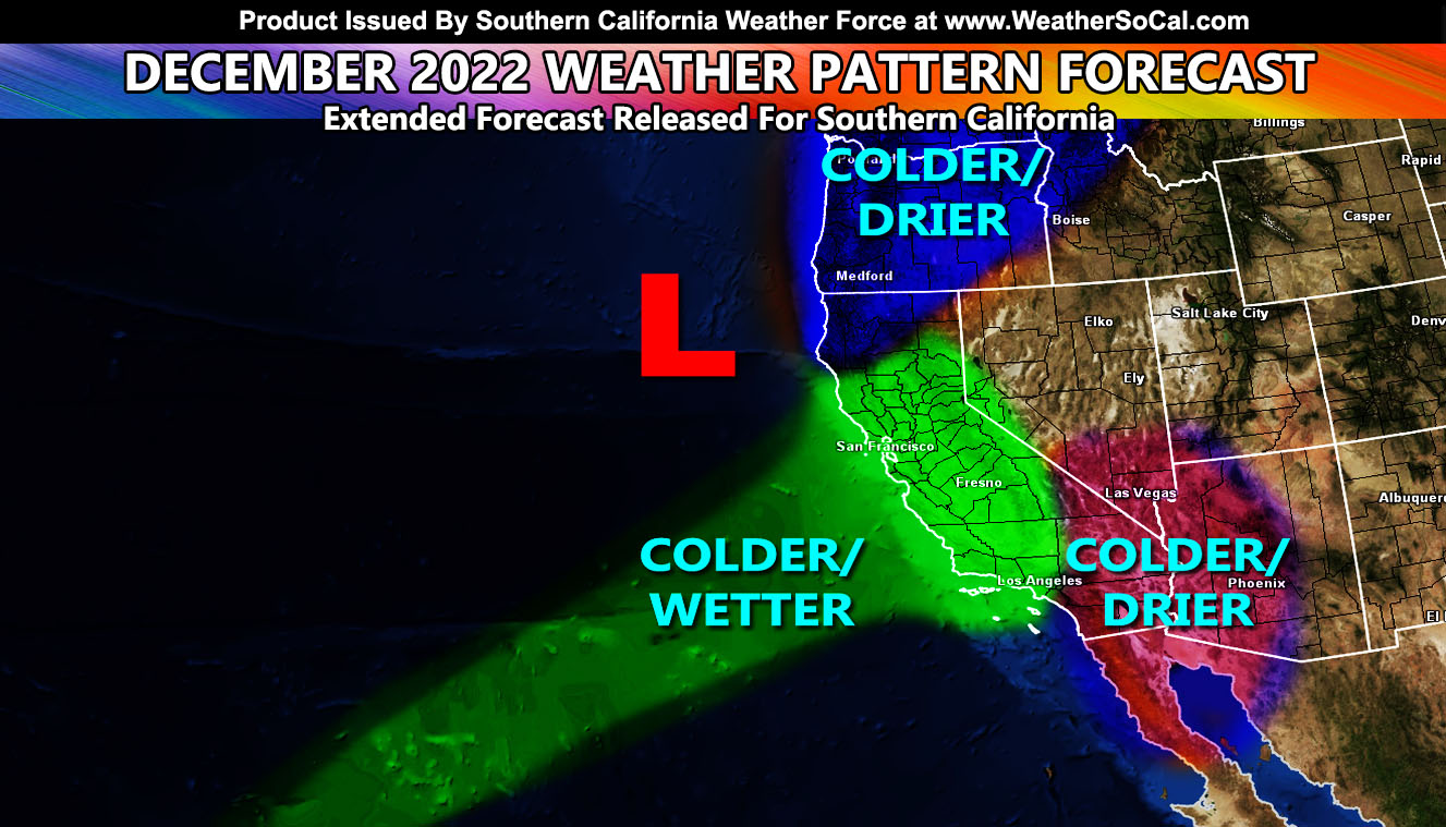
The November 2022 forecast went extremely well, calling for cooler than normal temperatures and above average precipitation. How will December 2022 look? Read on for details …
WANT THESE DELIVERED VIA THE APP? JOIN THE PATREON COMMUNITY TODAY FOR ALL THOSE PERKS INCLUDING BEING ON THE MICRO-CLIMATE ALERT SYSTEM BECAUSE NOT EVERY ALERT IS POSTED ON SOCIAL MEDIA FROM THIS WEATHER OFFICE – https://www.patreon.com/weatherforce
Join the Facebook Page for Further Updates If You Have Not Yet!
SOUTHERN CALIFORNIA WEATHER FORCE MAIN:
December 2022 is starting out with a moisture plume from the topics being aimed at California, minus areas south and east of Los Angeles. Heavy rain and Sierra Nevada snowfall will be the main story through the first half of the month, especially the beginning, just as we are seeing now.
A ridge of high pressure in the Gulf of Mexico is larger than normal. This is what is causing the cutoff from heavy precipitation for areas like Santa Barbara and San Luis Obispo and nothing in San Diego, which by geographical means is not too far away. This is a pretty rare setup to say the least.
We will see more of this throughout the month. In static, on average, an upper-level trough will be located west of Northern California, just off the coast. This will continue bringing in that moisture plume to the areas west of Los Angeles County where I do have above normal precipitation for this month in the forecast. Areas in Los Angeles proper may see just below the average. The average for December is 2.79 inches of rainfall, so we should see below that. It will be even drier in areas of the High and Low Desert, including the Inland Empire down through Orange and San Diego County as well. Basically, it means the forecast area will be split with more storms to the west of Los Angeles County and less to the south and east. Some will see more than they bargained for, others will miss the rain until January.
With that being said, I am going opposite of NOAA still with the temperatures. I do think December 2022 will be colder than normal for the entire Southern California region.
I pretty much have been counting on this since the release of my seasonal forecast, calling for below average temperatures and above average precipitation when the season is finally over after May 2023. Click here to read that article.
What does it mean for January? January is going to be setting up as an interesting month, with the tropical moisture plume expanding southward and bringing in more precipitation than December will. So, enjoy this month for your Christmas plans and activities leading up to it. Have your hot chocolate on hand as it will be a colder than normal month for our region.
WANT THESE DELIVERED VIA THE APP? JOIN THE PATREON COMMUNITY TODAY FOR ALL THOSE PERKS INCLUDING BEING ON THE MICRO-CLIMATE ALERT SYSTEM BECAUSE NOT EVERY ALERT IS POSTED ON SOCIAL MEDIA FROM THIS WEATHER OFFICE – https://www.patreon.com/weatherforce
Join The Main Southern California Weather Force Facebook Group (50 percent delivery time) – You can join the main SCWF page as well through that group.
Click Here To Join The Page Today

