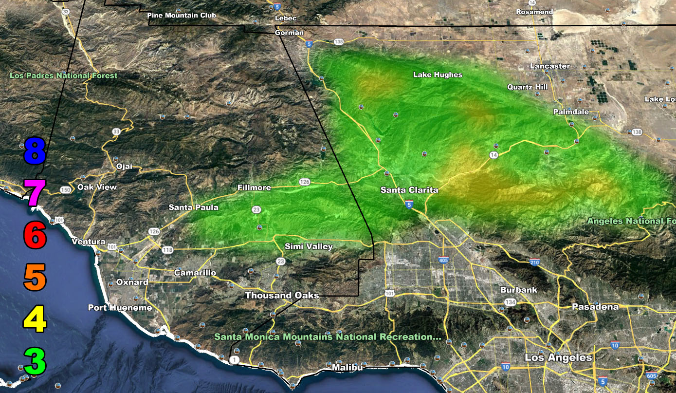
There is not much to say, it’ll be an advisory from tomorrow through Thursday … 30-45 mph gusts in the SCV, Acton, Fillmore etc zones on the map, you should know where you are, and hot air that could lead to a fire hazard, but given our drought is now over, that would seem to be low at the time so I’ll keep it a Santa Ana Wind Advisory … and yes, I will be bored till El Nino Season, which is usually after Halloween.
Raiden Storm Wind Gust Intensity Scale –
8. Extensive widespread damage.
7. Trees are broken or uprooted, building damage is considerable. – High Profile Vehicle Roll-Over CERTAIN.
6. SOME Trees are broken or uprooted, building damage is possible. – High Profile Vehicle Roll-Over Likely, Do NOT recommend Traveling in this zone. This zone also is the starting zone where trees and powerlines will fall and damage cars and even kill people near or in them!
5. Slight damage occurs to buildings, shingles are blown off of roofs. HIGH WIND WARNING CRITERIA – High Profile Vehicle Roll-Over Possible if weight is not corrected.
4. Twigs and small branches are broken from trees, walking is difficult.
3. Large trees sway, becoming difficult to walk. POWER SHUTDOWN THRESHOLD DURING FIRE WEATHER / WIND ADVISORY CRITERIA

