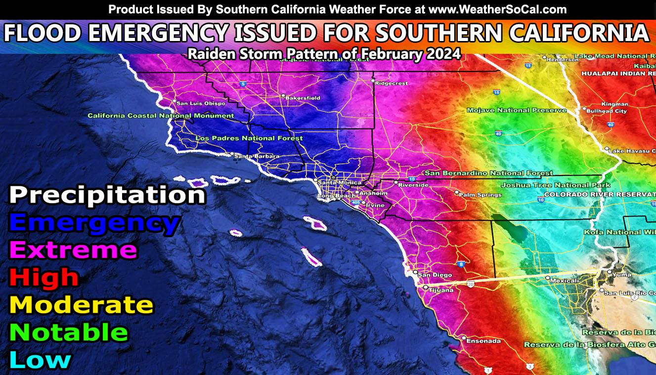
Southern California Weather Force has issued a Flood Emergency, effective Sunday through Wednesday morning as the bulk of the atmospheric river is set to aim Southern California.
The first storm is passing us as we speak now, but as stated in the previous article, we will be having a secondary one within the Raiden Storm Pattern of February 2024. This one would be four times stronger than the current one.
Southern California Weather Force Flood Risk Assessment Model clearly shows the rare dark blue areas. These areas will be Los Angeles, Ventura, Santa Barbara, and Kern County. Rain will start west of Los Angeles and Ventura later on Saturday, but the peak will be Sunday through Tuesday. Multiple days of rain will be expected in the emergency areas as the atmospheric river becomes stuck, which is known as a firehose scenario.
Estimations are that Downtown Los Angeles would see another 4-6″ of rainfall on top of what fell today. Rainfall totals will be higher near and along the southern slopes of the Los Angeles, Ventura, and Santa Barbara County Mountains as well.
This column of moisture is very deep, extending well into the jet stream levels. This means that even you in Kern and the Deserts will see heavy rainfall and flooding with this scenario.
As for the rest of us, just because you are not in an emergency shading, the rest of the metros from Orange, San Diego, and the Inland Empire to High Desert areas will be in the extreme category. So, this still means major flooding is to be expected during the multi-day event.
Southern California Weather Force will handle all official forecast updates from here on out for this next storm pattern. As we near it, more information will be given, along with the zoom-in maps you enjoy so much.
A Raiden Storm Pattern means a pattern that was foreseen ahead of any source, which; like a comet, bears the name of the scientist who saw it.
Stay tuned to Southern California Weather Force for further updates …

