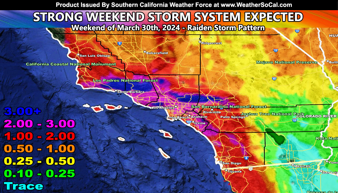
Southern California has issued an update to the end month strong storm pattern, effective now until we get closer to the event.
First and foremost, I will say again, I do not accept or keep comments that ask me ‘I’m hearing of a storm coming etc.” You do realize I predicted this pattern over two weeks ago. (Reference A Below) I called the 24th as the start of the pattern and we will continue it. Nothing gets by when the scope is 2-3 weeks out. I post when I am good and ready, not when I am pushed. Since it was called two weeks ago, before anything else, this is called a Raiden Storm Pattern. I simply do NOT want to hear, I heard, I saw, etc unless you talk about my hard-working long range calls.
A storm system will move into the region on Friday night for areas west of Los Angeles, moving through the rest of the forecast area over the day on Saturday. The back end of the system will hit on Easter Sunday.
The system has the potential to bring flooding conditions to the metro and mountain areas, in-which the rain model here at Southern California Weather Force is the image in this article.
The snow-level may dip down to the 5,000 FT mark, or even a bit lower. It is the end of March, and the sun angle will not allow them to bottom out much below that.
LONG RANGE: More systems are likely the first week of April. I am planning a trip to Southern Texas for the eclipse; however, I am watching that day carefully. As of right now, a storm could impact the viewing site, which will make me cancel the trip before I even go.
A Raiden Storm Pattern means a storm pattern that was predicted before any other model, person, or service did and bears the name of the one that predicted it so that history will know such, me.
Reference A – Initial Pattern Call Three Weeks Ago – https://www.southerncaliforniaweatherforce.com/2024/03/07/long-range-weather-advisory-issued-possible-strong-santa-ana-wind-event-within-a-week/
Stay tuned to Southern California Weather Force for updates to this, or any other future forecasts …

