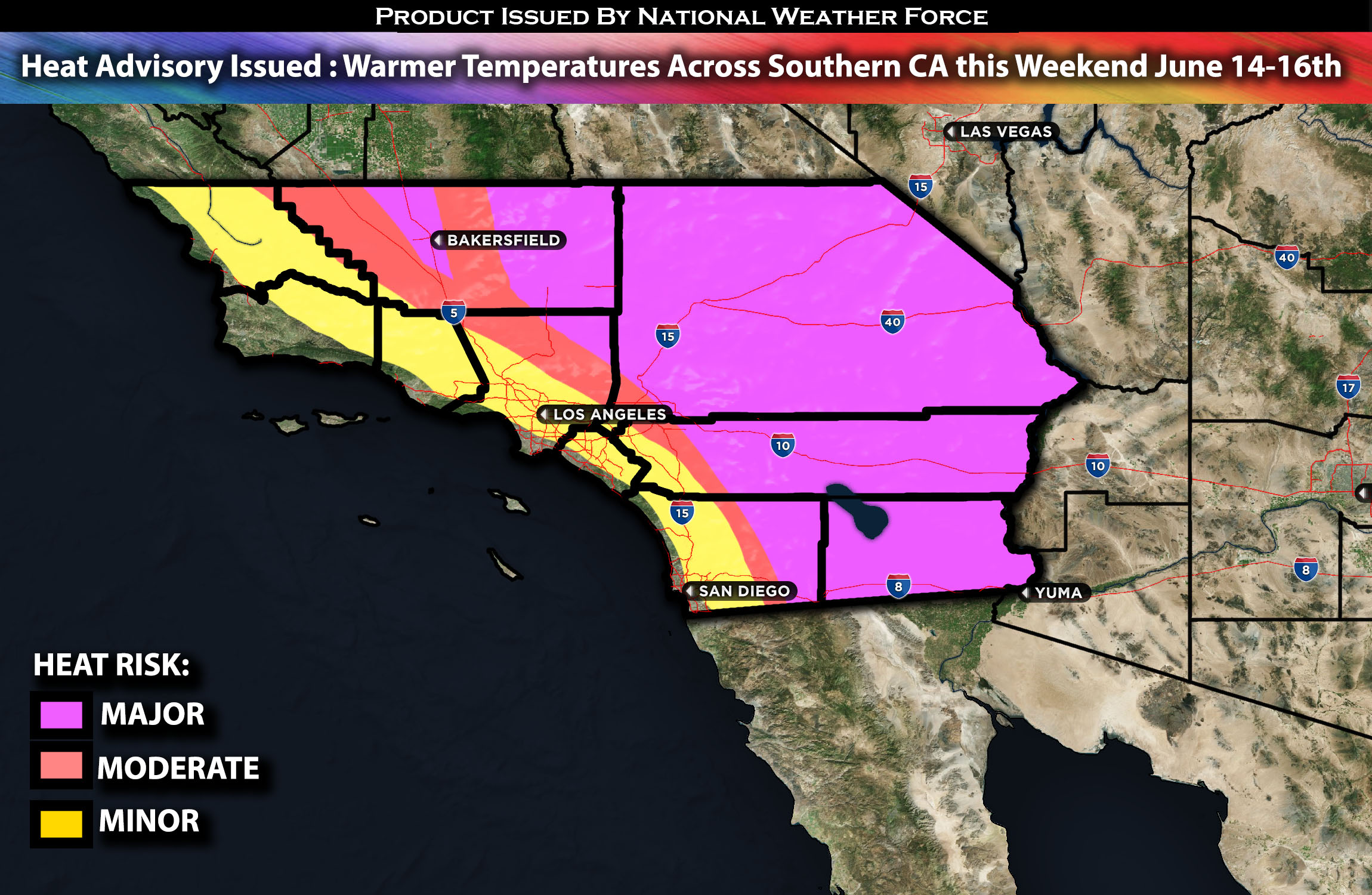
Across Southern California:
An upper-level low will continue to move eastward tonight, contributing to a deeper marine layer observed during the morning hours. This will give way to a weak, broad upper high-pressure system building into the region. This change will result in significant warming in some areas and reduced cloud cover in others. Continue reading to see which regions will experience each type of weather with further details.
Coastal Regions:
The marine layer is expected to decrease in depth due to rising heights, resulting in less inland penetration of low clouds tonight and Friday morning. Clouds will likely remain below the coastal slopes and may not even reach the Santa Clarita Valley. With the onshore flow weakening, faster clearing is anticipated in most areas on Friday, with sunshine likely appearing at most beach locations, making for a nice day at the beach. Temperatures will be mainly in the 70s at the coast and upper 60s at the beaches mainly.
Inland Areas:
Expect reduced marine layer coverage, with some areas clearing completely by the afternoon due to weaker onshore winds and the building ridge. Temperatures will be warmer, mostly in the mid-70s, with some areas reaching the low 80s.
Heat Advisory Across the Valleys, Mountains and Deserts:
As the ridge builds, temperatures are expected to rise by 5 to 10 degrees. Valleys will reach the upper 80s to low 90s, mountains will be in the 90s, and deserts will hit the 100s, with some areas reaching 105-110 locally, such as the Coachella Valley, Palm Springs, Ocotillo Wells, Borrego Springs, and Thermal area. Therefore, a heat advisory is issued for this area given the favorable conditions for heat risk.
Check below for temperature maps specific to your area.
Approximate Maximum High Temperatures:

Stay tuned for more updates.
Sina⚡⚡
With over a decade of experience in forecasting severe thunderstorms, this individual is a seasoned forecaster and developer. Their expertise in severe weather forecasting and computer science is entirely self-taught, complemented by a foundation in Atmospheric Science from UNCO and an IT background from WGU. They have dedicated their efforts to developing innovative tools that enhance the accuracy of analyzing large hail and tornadoes. As a significant contributor and partner at National Weather Force Innovations LLC, they have played a crucial role in providing accurate and timely information. Additionally, they have been instrumental in developing tools and organizing projects that focus on accuracy and performance, ensuring those affected are well-informed.
