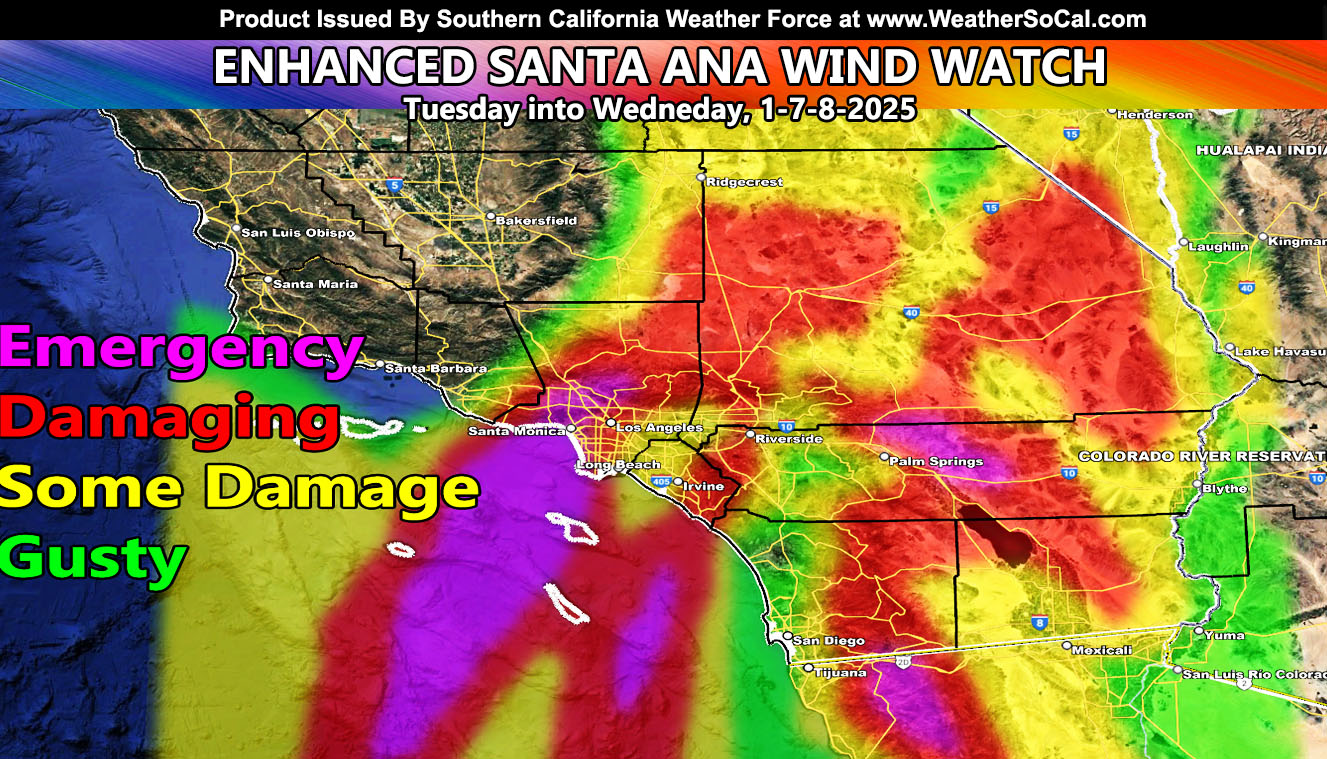
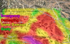
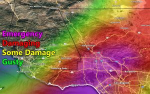
Southern California Weather Force has upgraded the Santa Ana Wind Watch to Enhanced Santa Ana Wind Watch, one away from a warning, for Tuesday into Wednesday, January 7th through 8th, 2025.
NOTE: You flying into Ontario International Airport, expect a divert to Phoenix or Las Vegas on this one.
Discussion: As stated for days, upper support will play the most powerful role on this. A storm system from Alaska will drop into Western Canada and eventually pass Southern California. This system will drop south into Mexico. The northeast to southwest flow on the western periphery will be what will make this an extremely dangerous event for the areas on the Southern California Weather Force risk model above.
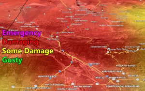
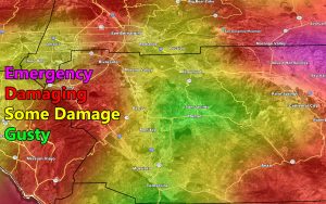
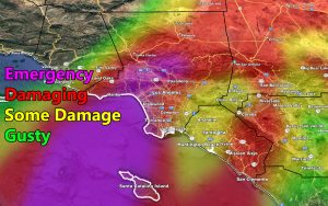
As you can see, the northern flow will hit The San Fernado Valley the hardest, including the Santa Monica zones during the allotted time. Also, you have the Inland Empire easily on this, especially from Fontana through Corona and into Orange County. Furthermore, you have the low deserts. Look at the Coachella Valley off the Joshua Tree National Park. Basically, this is going as expected, and if you didn’t prepare on my forecast, you will just … well … lose out … Tomorrow’s update will be the final 1-8 wind numbers …
An Enhanced Santa Ana Wind Watch is issued when conditions move from the initial call of Santa Ana Wind Watch to a stronger situation and must be acted on now if you’re in the wind area
LONG RANGE: Still thinking after the 18th on a storm pattern in the Southwestern United States
Use the images here to see a zoom in of your area from the Southern California Weather Force risk model of wind damage –
Raiden Storm
Master General Meteorologist

