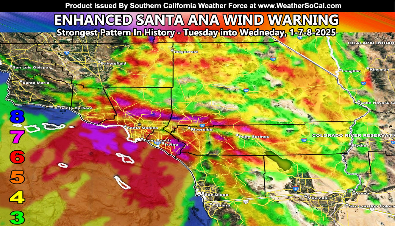
Southern California Weather Force has upgraded the Enhanced Santa Ana Wind Watch to an official Enhanced Santa Ana Wind Warning, effective Tuesday into Wednesday, January 7th into the 8th, 2025, in what will be the strongest and rarely most widespread Santa Ana Wind Event in recorded history.
A storm system dropping into the area will put the entire forecast warning zone under a strong 150 mph upper-level jet stream out of the north. This jet stream will work with the cold air. Cold air sinks and hot air rises. We have the colder air up there now, which means this will transfer into the surface. As it hits the local mountains especially, it will jet southward and downward.
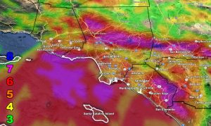
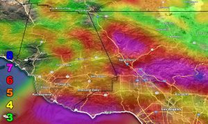
Here is the kicker. Southern California Weather Force models actually show a mountain wave developing over the Los Angeles County Mountains. This means, that on this historic rare occasion, the Los Angeles Basin will see these damaging winds. According to the Southern California Weather Force model, Downtown Los Angeles will see stronger winds than even parts of the Inland Empire.
What this means is this event is not just for or limited to the Santa Ana Wind Prone Zones. This is a widespread, quite possibly an event that will make history.
SNOW: Big Bear – I am giving you one to two inches of snow through this event as this is a ‘backdoor cold front’. So, expect some fun out of that for you up there.
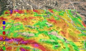
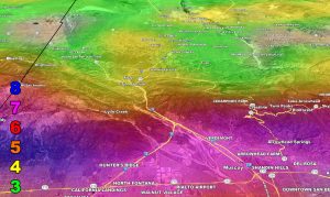
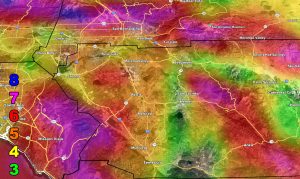
Here are the zoom-in models from this weather office. Use the wind key provided.
Raiden Storm Wind Gust Intensity Scale –
8. Extensive widespread damage.
7. Trees are broken or uprooted, building damage is considerable. – High Profile Vehicle Roll-Over CERTAIN.
6. SOME Trees are broken or uprooted, building damage is possible. – High Profile Vehicle Roll-Over Likely, Do NOT recommend Traveling in this zone. This zone also is the starting zone where trees and powerlines will fall and damage cars and even kill people near or in them!
5. Slight damage occurs to buildings; shingles are blown off of roofs. HIGH WIND WARNING CRITERIA – High Profile Vehicle Roll-Over Possible if weight is not corrected.
4. Twigs and small branches are broken from trees, walking is difficult.
3. Large trees sway, becoming difficult to walk. POWER SHUTDOWN THRESHOLD DURING FIRE WEATHER / WIND ADVISORY CRITERIA
Raiden Storm
Master General Meteorologist

