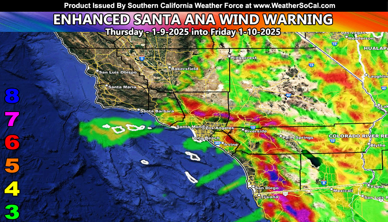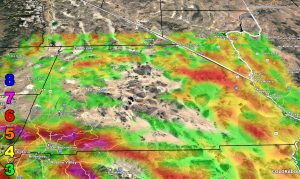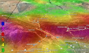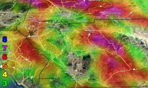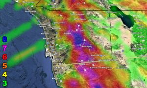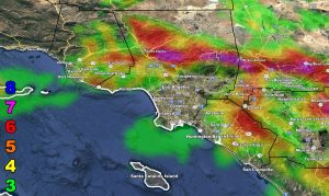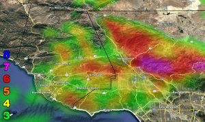
Southern California Weather Force has extended the Enhanced Santa Ana Wind Warning, effective today, tonight into Friday, January 9th into the 10th, 2025.This will not be a long typed up article. As stated, we would have another Santa Ana Wind Event end week. This will the one talked about. We will start these wind gusts shortly, which will increase the entire day and into the overnight, and through Friday. Expecting the San Diego County Mountains to get absolutely nailed with the drainage effect out of the east between midnight tonight and noon Friday, a solid 12 hours of damaging winds there.
LONG RANGE: Another Santa Ana Wind Pattern is scheduled Sunday, then again on Tuesday.
For the rest of you, use the Southern California Weather Force Wind Maps – San Diego County is a new zoom-in map as well.
Here are the zoom-in models from this weather office. Use the wind key provided.
Raiden Storm Wind Gust Intensity Scale –
8. Extensive widespread damage.
7. Trees are broken or uprooted, building damage is considerable. – High Profile Vehicle Roll-Over CERTAIN.
6. SOME Trees are broken or uprooted, building damage is possible. – High Profile Vehicle Roll-Over Likely, Do NOT recommend Traveling in this zone. This zone also is the starting zone where trees and powerlines will fall and damage cars and even kill people near or in them!
5. Slight damage occurs to buildings; shingles are blown off of roofs. HIGH WIND WARNING CRITERIA – High Profile Vehicle Roll-Over Possible if weight is not corrected.
4. Twigs and small branches are broken from trees, walking is difficult.
3. Large trees sway, becoming difficult to walk. POWER SHUTDOWN THRESHOLD DURING FIRE WEATHER / WIND ADVISORY CRITERIA


Raiden Storm
Master General Meteorologist

