
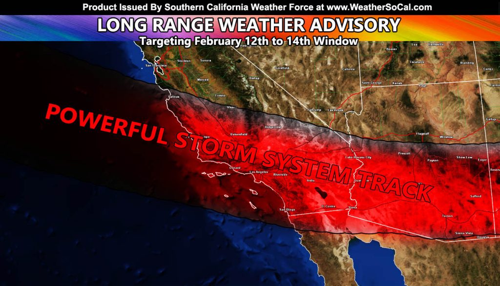
Southern California Weather Force has issued a Long Range Weather Advisory out ahead of a rare type of storm system to hit the Southern California areas, effective February 12th through the 14th, but realistically could narrow to February 12th to the 13th.
A storm system of this type is very rare. Normally, Southern California gets slow moving cold fronts due to storms moving north of the area. This one however is different. The jet stream will align in a way where a fast west to east flow will move over the area.
It means that it will be a very quick, yet potent weather pattern, giving the area heavy rain along with thunderstorms. Yes, with such a pattern (punch in the face) we normally get thunderstorms along a fast moving bow echo shaped cold front.
SNOW: Yes, this will bring snow to the local mountains as this will be a colder system due to the lack of warm southerly flow. The snow-level for the average would be around 5,000 FT, but due to the colder air with the fast westerly flow, the Kern County Mountains may be the place to be if you want the highest accumulation, so I will be watching those mountains closely as time goes on.
NOTE: This is the type of system I was looking for when I predicted the first or second week of this month to have flooding capable of bringing dangerous mudslides to the burn areas. If you are in one of those zones, you should prepare for that.
As always, stay tuned to updates here at Southern California Weather Force.
Raiden Storm
Master General Meteorologist