
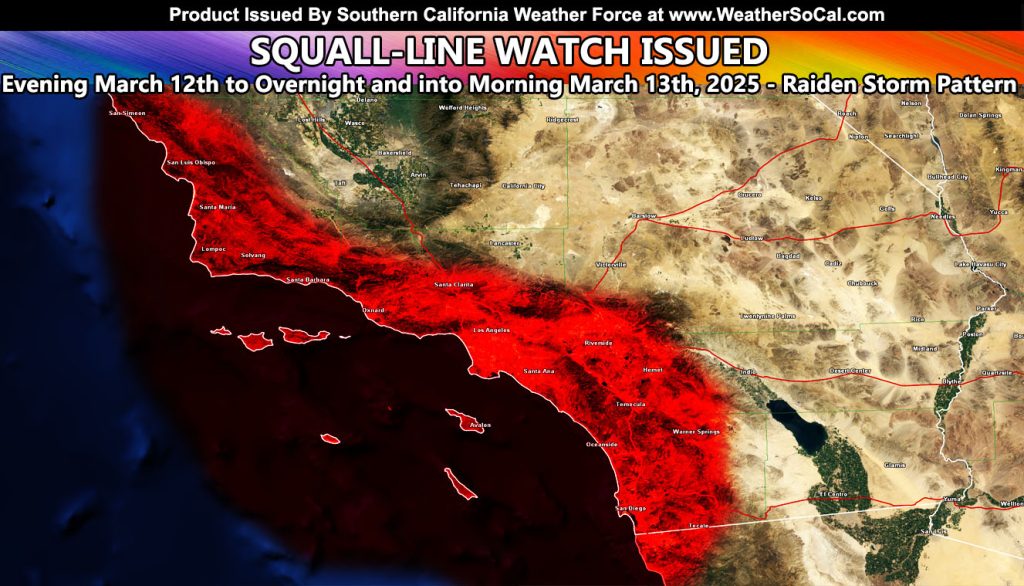
Southern California Weather Force has issued a Squall-line Watch effective this evening, tonight, into Thursday morning.
A strong cold front will move through Southern California during the effective watch period. This cold front will bring heavy rain, isolated thunderstorms, strong winds, and heavy mountain snow.
While it will rain out ahead or it, the squall-line is a quick hitting sharp front that will leave as fast as it hits so here are the times for the impact.
SLO and Vandenberg … 7pm
Santa Barbara … 10pm
Ventura … Midnight
Los Angeles … 2am Thursday
Anaheim … 3am
Corona and Ontario … 4am
San Diego … 5am
A Squall-line Watch is issued here at Southern California Weather Force when a frontal zone capable of 35 to 50 mph wind gusts moves through. Within this, Severe Thunderstorm Warnings may appear on your phone from other sources, even without lightning. Storms like this can also bring waterspouts ashore as small tornadoes
Remember for the rest of you, the rain and snow models at this link are still in the forecast for this system – https://www.southerncaliforniaweatherforce.com/2025/03/10/final-storm-details-tuesday-into-thursday-of-this-week-march-11th-to-13th-2025-rain-and-snow-models/
Raiden Storm
Master General Meteorologist