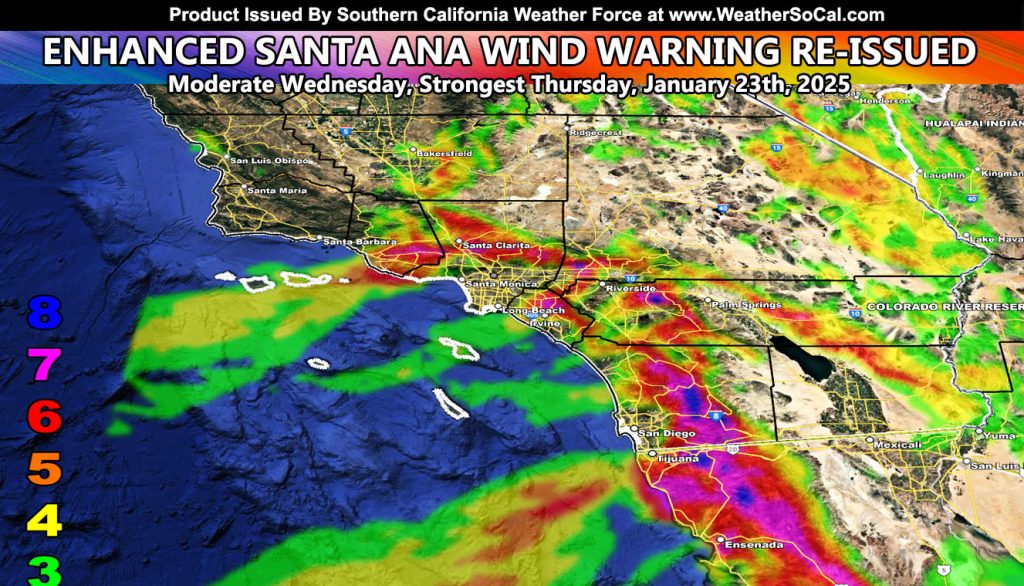
Southern California Weather Force has re-issued the Enhanced Santa Ana Wind Warning from the last update for this prolonged Santa Ana Wind Event, with maps you can read for the entire region.
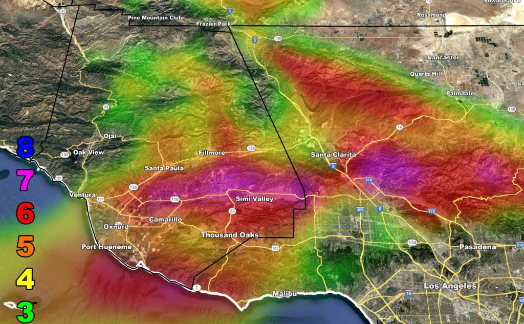
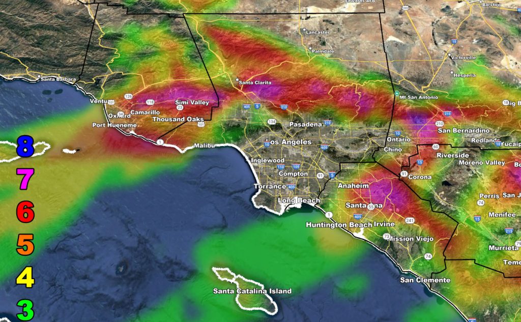
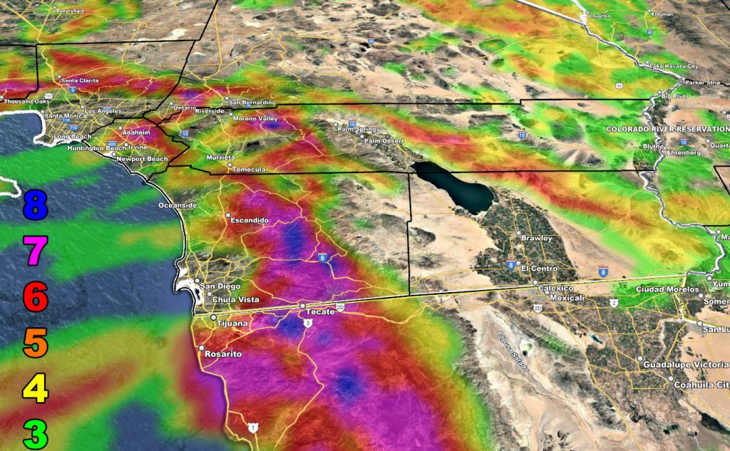
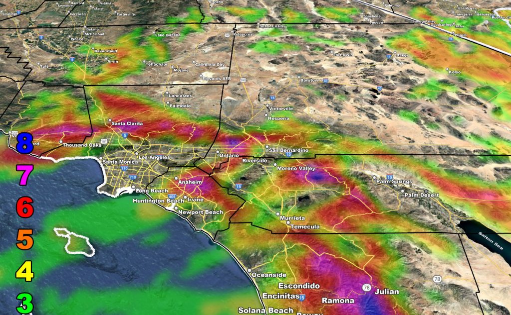
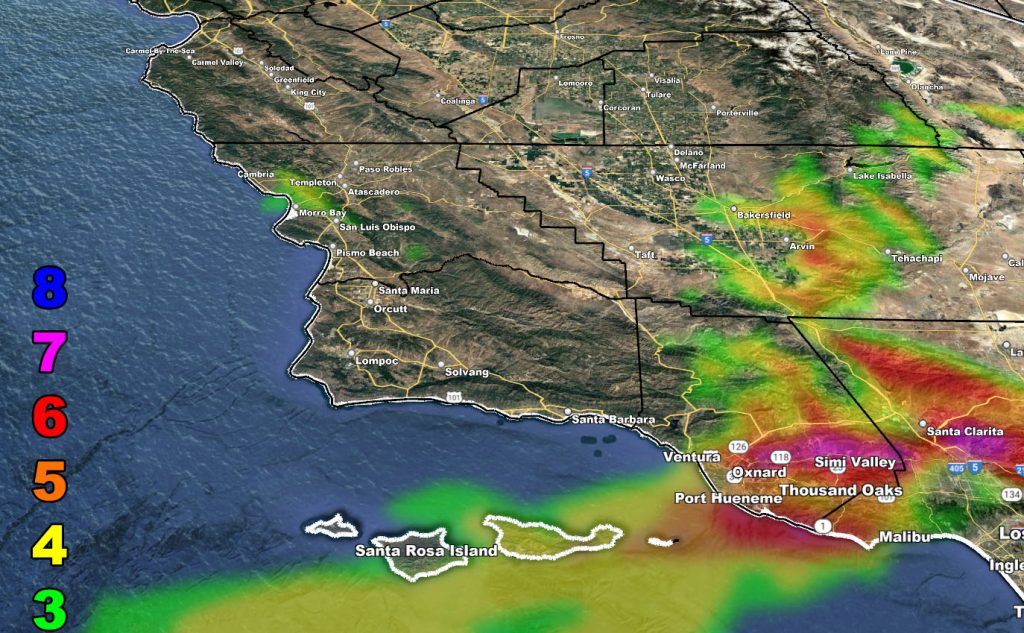
Winds will start back up again today but gain momentum and be the strongest on Thursday. The maps show the key locations. You can note Pasadena is not in it yet just to the northwest along the I-5 corridor into the Santa Clarita Valley zones is, and west through Ventura County as well.
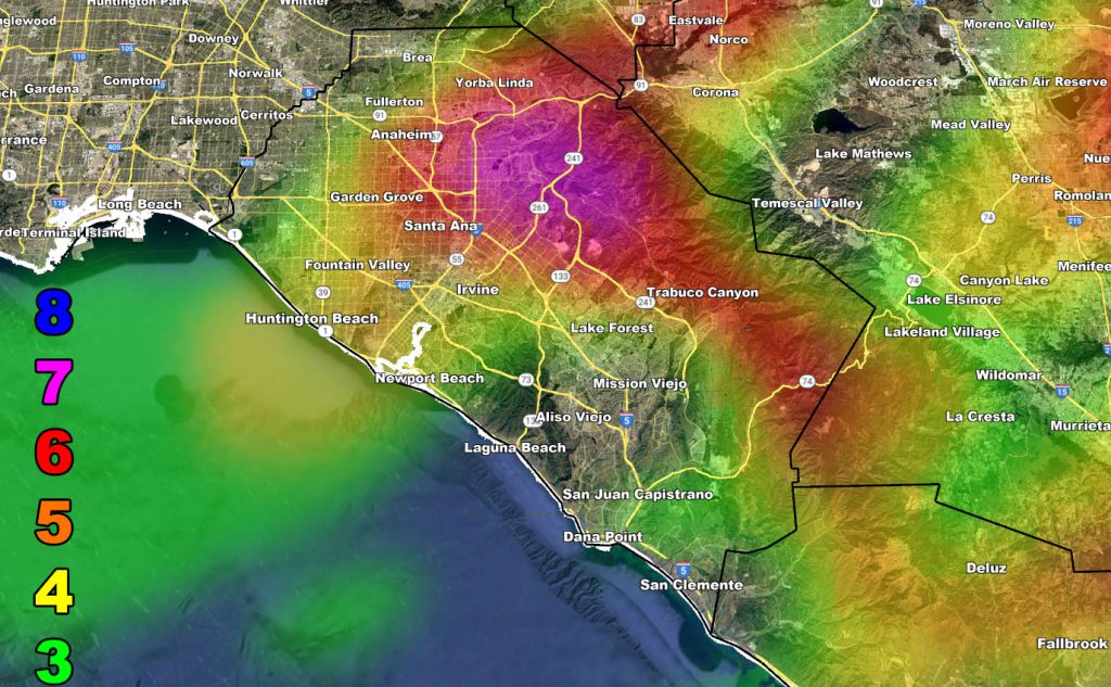
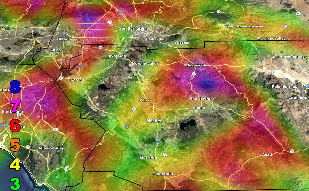
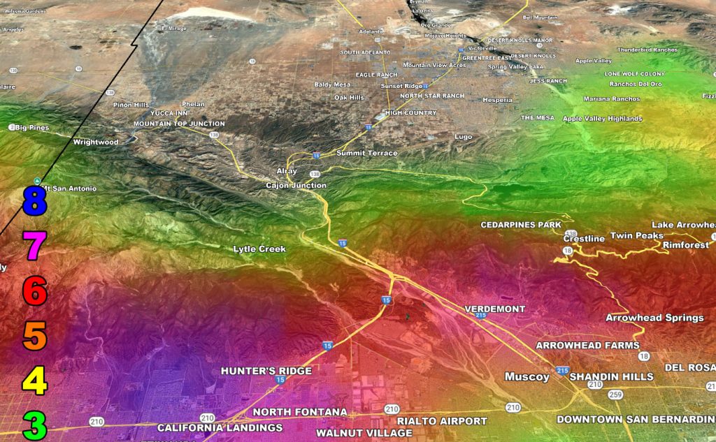
I-15 Corridor from the Cajon Pass south through Ontario, Chino Hills, Jurupa Valley, Norco, and Corona as well as these travel the Santa Ana River into Orange County.
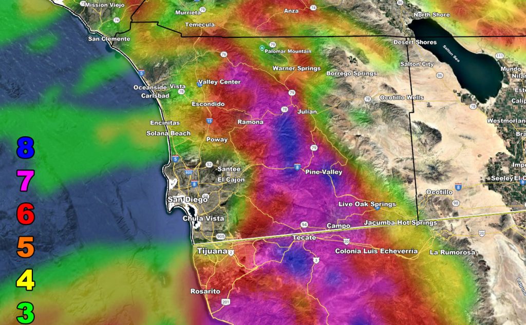
The strongest will be in the San Diego County Mountains, and Northern Baja, Mexico.
This is a dangerous situation for level 5 and above.
LONG RANGE: Still watching the inside slider cold storm system for the weekend. Updates will come as numbers are crunched. For now, use the maps.
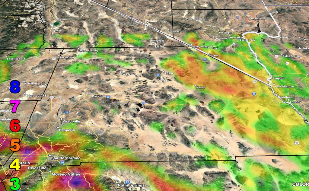
Here are the zoom-in models from this weather office. Use the wind key provided.
Raiden Storm Wind Gust Intensity Scale –
8. Extensive widespread damage.
7. Trees are broken or uprooted, building damage is considerable. – High Profile Vehicle Roll-Over CERTAIN.
6. SOME Trees are broken or uprooted, building damage is possible. – High Profile Vehicle Roll-Over Likely, Do NOT recommend Traveling in this zone. This zone also is the starting zone where trees and powerlines will fall and damage cars and even kill people near or in them!
5. Slight damage occurs to buildings; shingles are blown off of roofs. HIGH WIND WARNING CRITERIA – High Profile Vehicle Roll-Over Possible if weight is not corrected.
4. Twigs and small branches are broken from trees, walking is difficult.
3. Large trees sway, becoming difficult to walk. POWER SHUTDOWN THRESHOLD DURING FIRE WEATHER / WIND ADVISORY CRITERIA
Raiden Storm
Master General Meteorologist
