![](https://www.southerncaliforniaweatherforce.com/wp-content/uploads/2025/02/2122025ArticleA-1024x586.jpg)
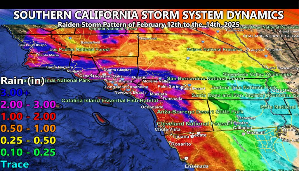
Southern California Weather Force has issued the Final Forecast for the storm of February 13th, into the 14th, 2025, with rain, wind, and snow maps included.
Not much to say about the storm other than it remains on the track we called for three weeks ago, in being the strongest system to hit our area this season thus far.
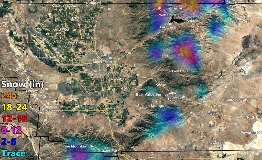
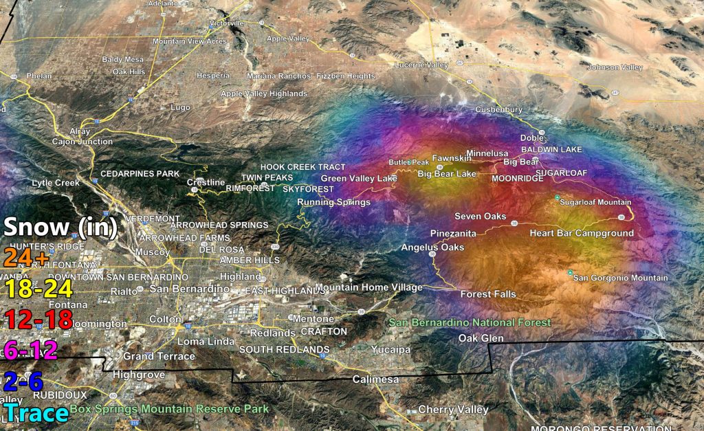
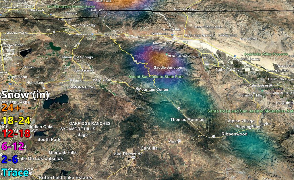
What I can say is there will be colder air behind the front, lasting into Friday. This is a reason our models are predicting heavier snow in upper Big Bear Lake locations with it. Now, long the main front Thursday night, snow-levels will be 7,000 FT. This means there will be a fine line between heavy snow and heavy rain/mixing in the Big Bear Lake area. Upper Moonridge stands the best chance at heavy snow accumulation, then we get the level dropping overnight into Friday for residual snow showers for lake level.
As stated previously, this is a burn area hit, so if you are near a burn area, keep an eye on the conditions as the front moves through.
Thunderstorm dynamics will be given the morning of the event, not now, as those dynamics warrant more monitoring. We will have the risk of waterspouts landfalling to small tornadoes along the entire coastal zone. So, I will list select cities and the timing of the main part of the frontal zone for these dynamics right now. All times will start Thursday evening and go into overnight Thursday so pay attention on that.
San Luis Obispo – 3pm
Vandenberg Space Force Base – 4pm
Santa Barbara – 5pm
Ventura – 7pm
Malibu – 8pm-9pm
LAX – 9pm
Long Beach – 9pm
Huntington Beach – 10pm
Laguna Beach – 11pm
Oceanside – 11pm to midnight
San Diego – 1am (on a weakening trend, not as much as the ones from SLO, SBA, VT, LA, OC.
Long Range: March looks to have more storms around the same time we started ours this month, till then, enjoy what rain you get.
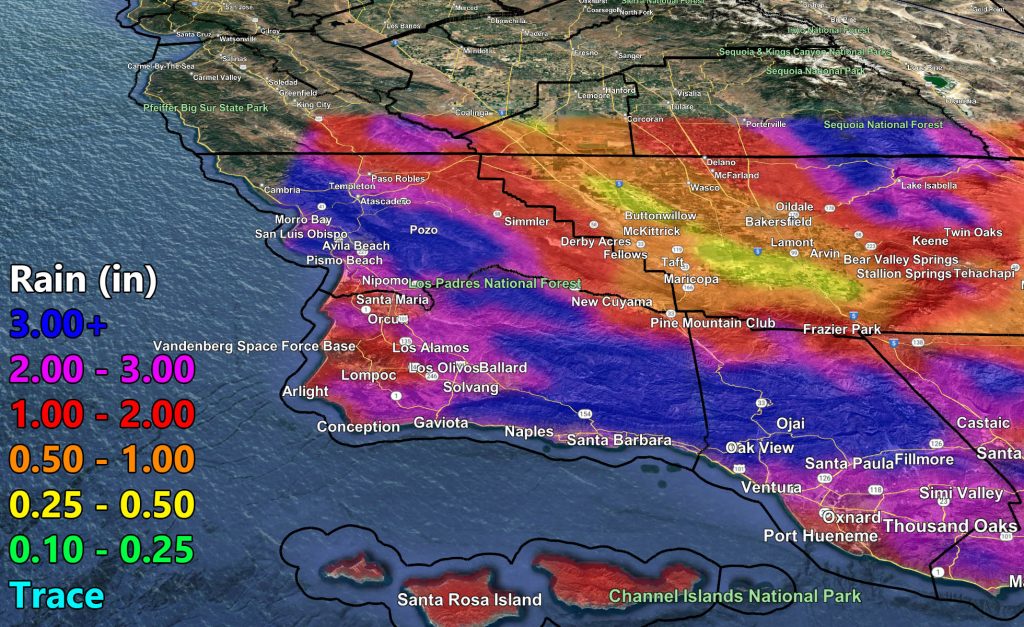
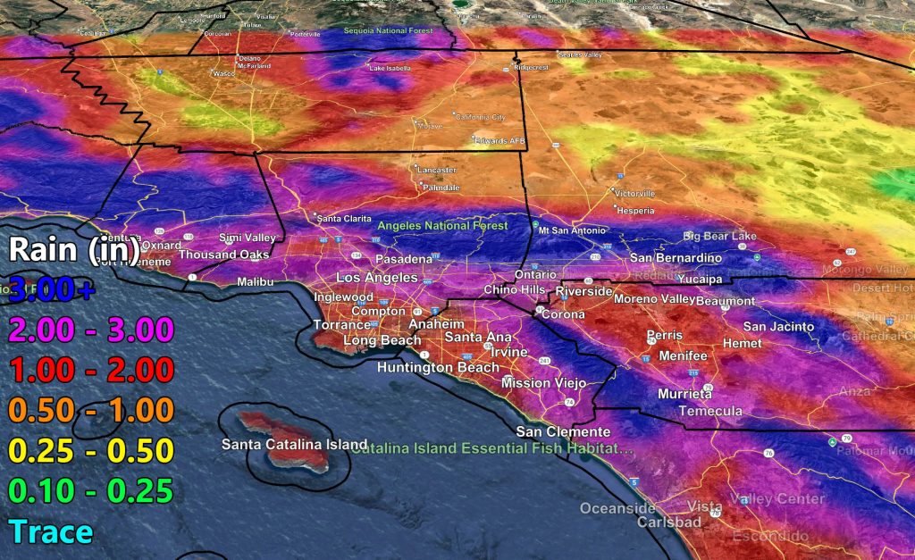
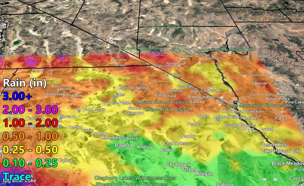
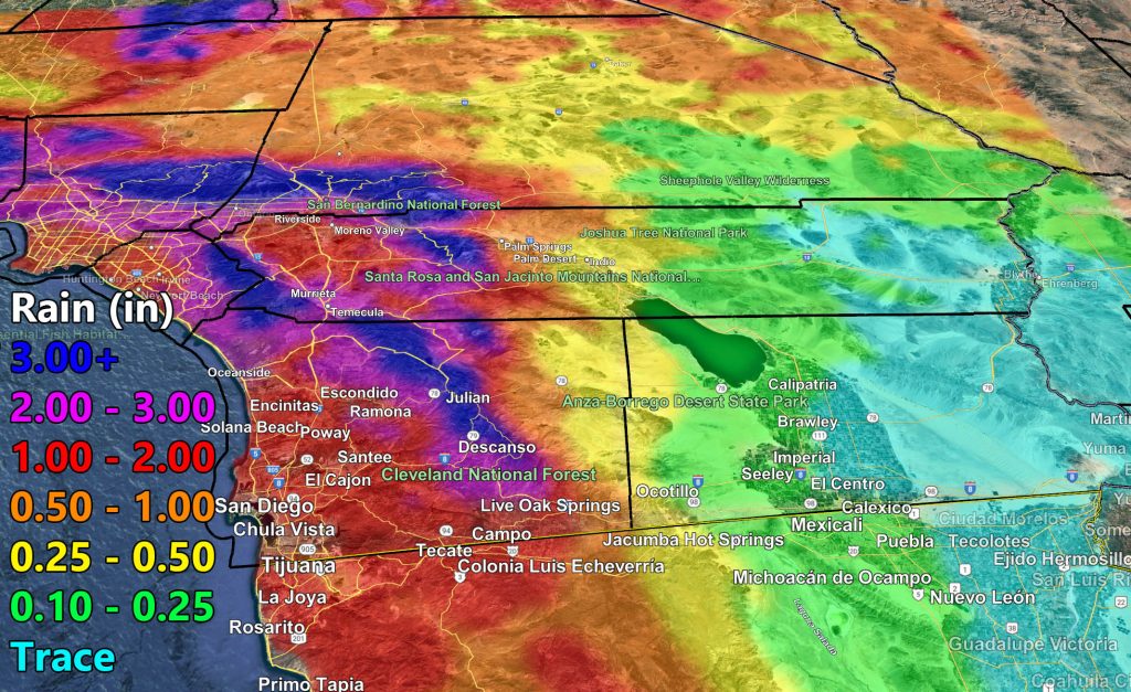
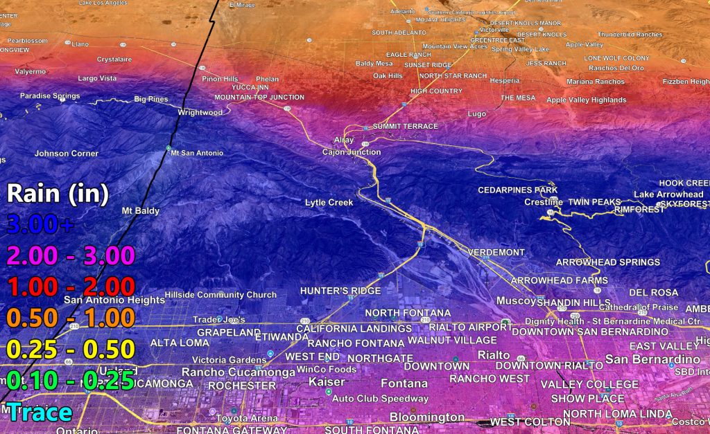
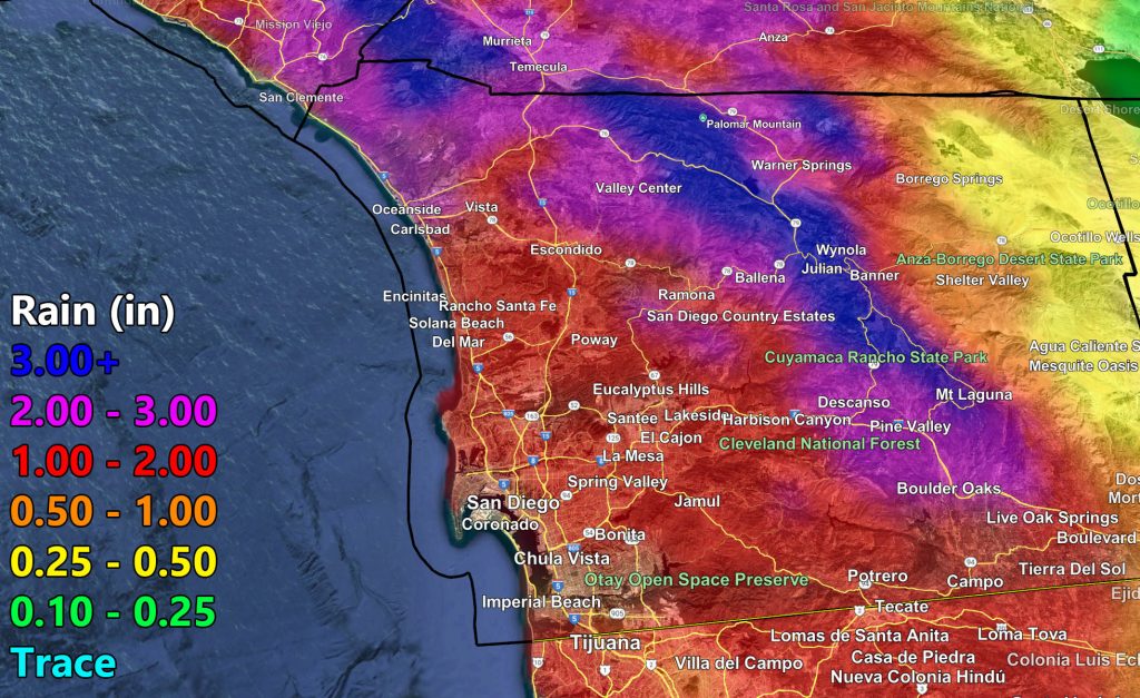
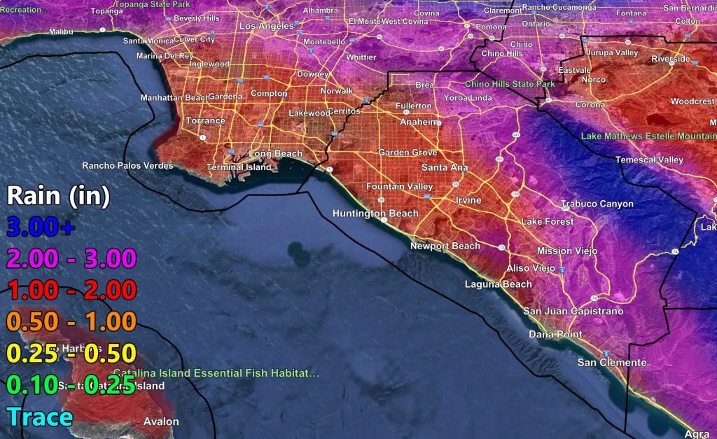
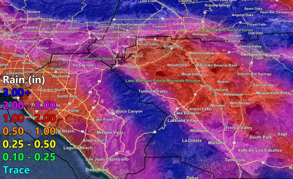
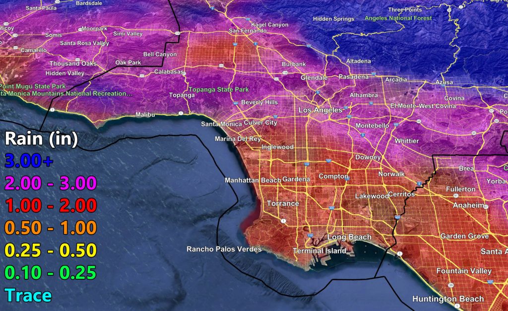
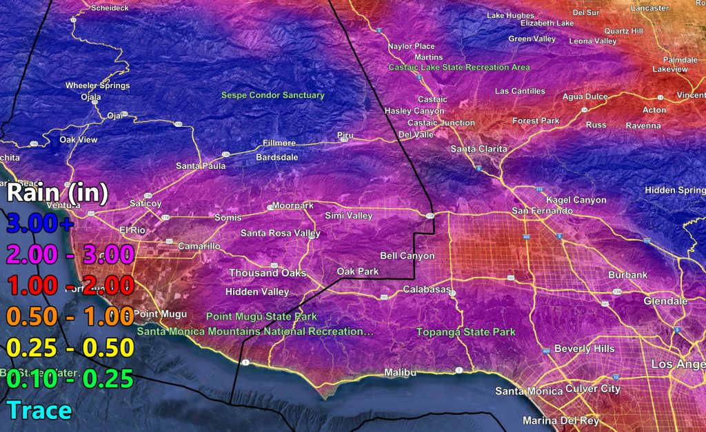
Rain (to zoom, right click and hit open image of some sort, or a device use your thumbs to zoom in)
![](https://www.southerncaliforniaweatherforce.com/wp-content/uploads/2025/02/2122025RainA-1024x627.jpg)
![](https://www.southerncaliforniaweatherforce.com/wp-content/uploads/2025/02/2122025RainB-1024x627.jpg)
![](https://www.southerncaliforniaweatherforce.com/wp-content/uploads/2025/02/2122025RainD-1024x627.jpg)
![](https://www.southerncaliforniaweatherforce.com/wp-content/uploads/2025/02/2122025RainC-1024x627.jpg)
![](https://www.southerncaliforniaweatherforce.com/wp-content/uploads/2025/02/2122025RainE-1024x627.jpg)
![](https://www.southerncaliforniaweatherforce.com/wp-content/uploads/2025/02/2122025RainG-1024x627.jpg)
![](https://www.southerncaliforniaweatherforce.com/wp-content/uploads/2025/02/2122025RainH-1024x627.jpg)
![](https://www.southerncaliforniaweatherforce.com/wp-content/uploads/2025/02/2122025RainF-1024x627.jpg)
![](https://www.southerncaliforniaweatherforce.com/wp-content/uploads/2025/02/2122025RainI-1024x627.jpg)
![](https://www.southerncaliforniaweatherforce.com/wp-content/uploads/2025/02/2122025RainJ-1024x627.jpg)
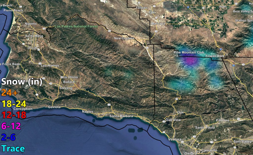
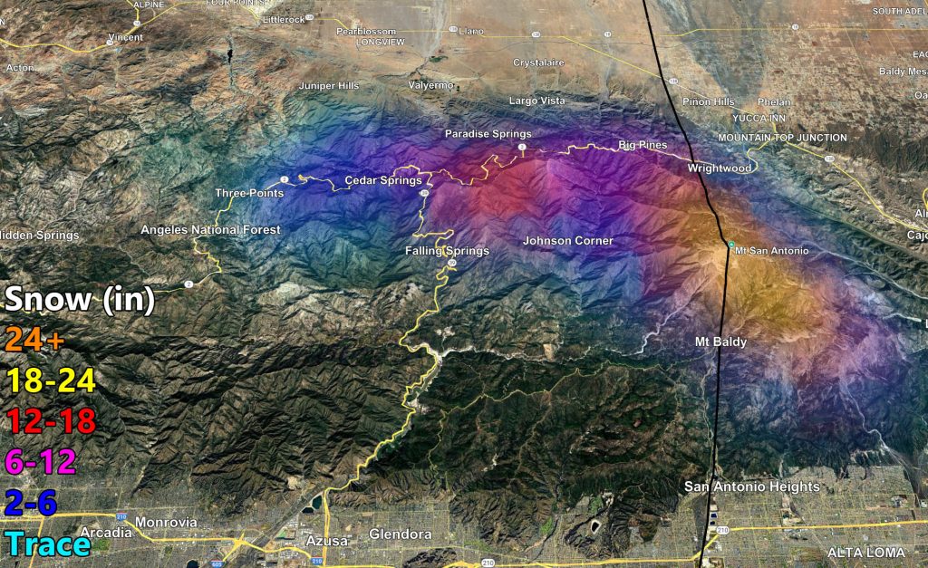
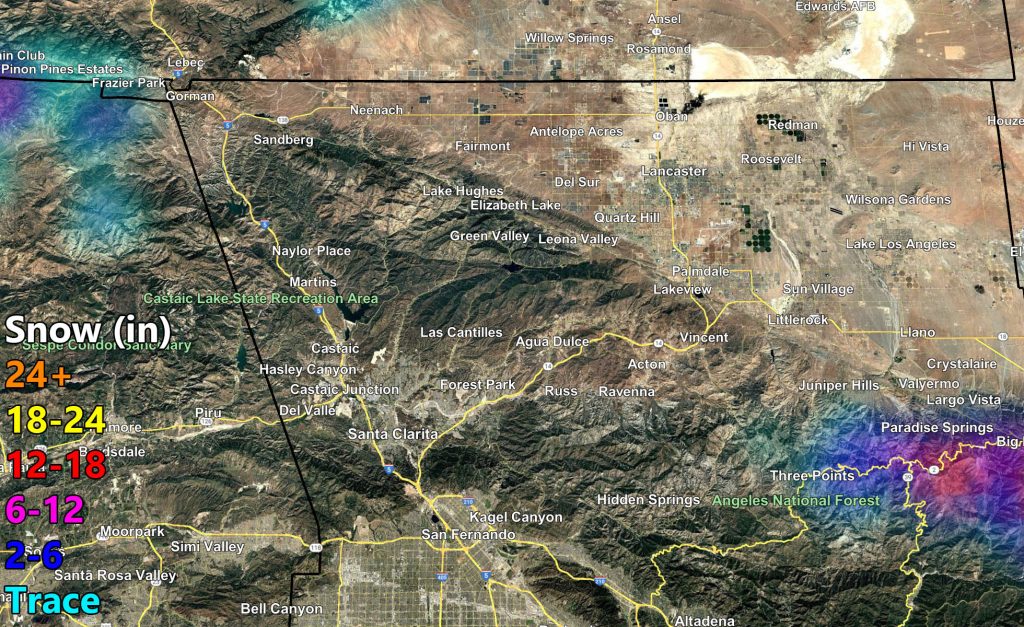
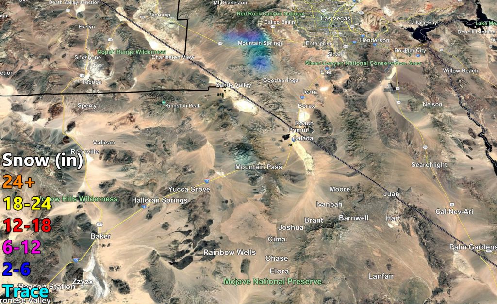
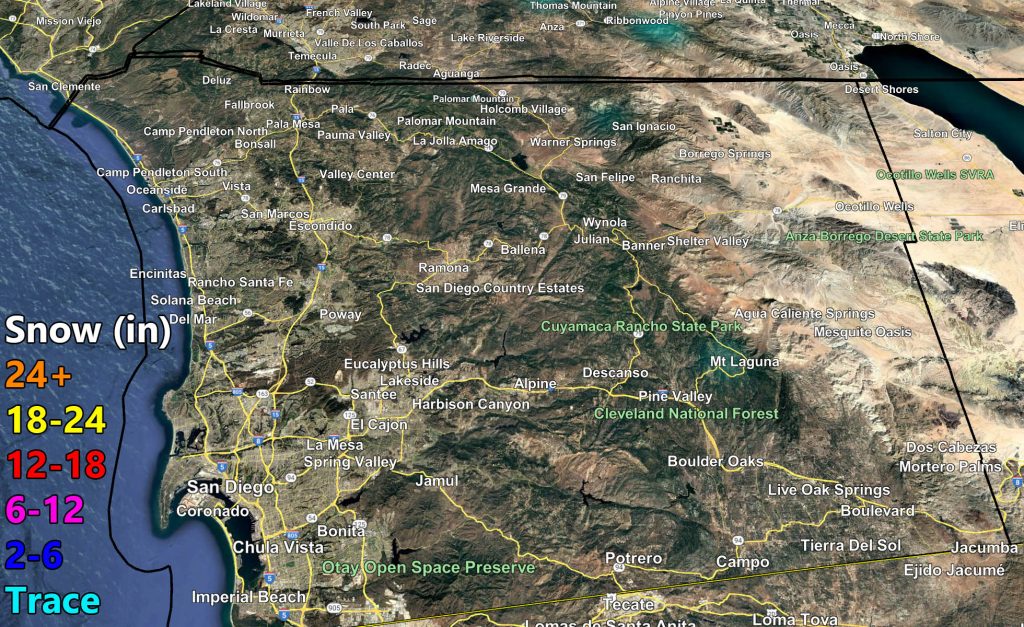
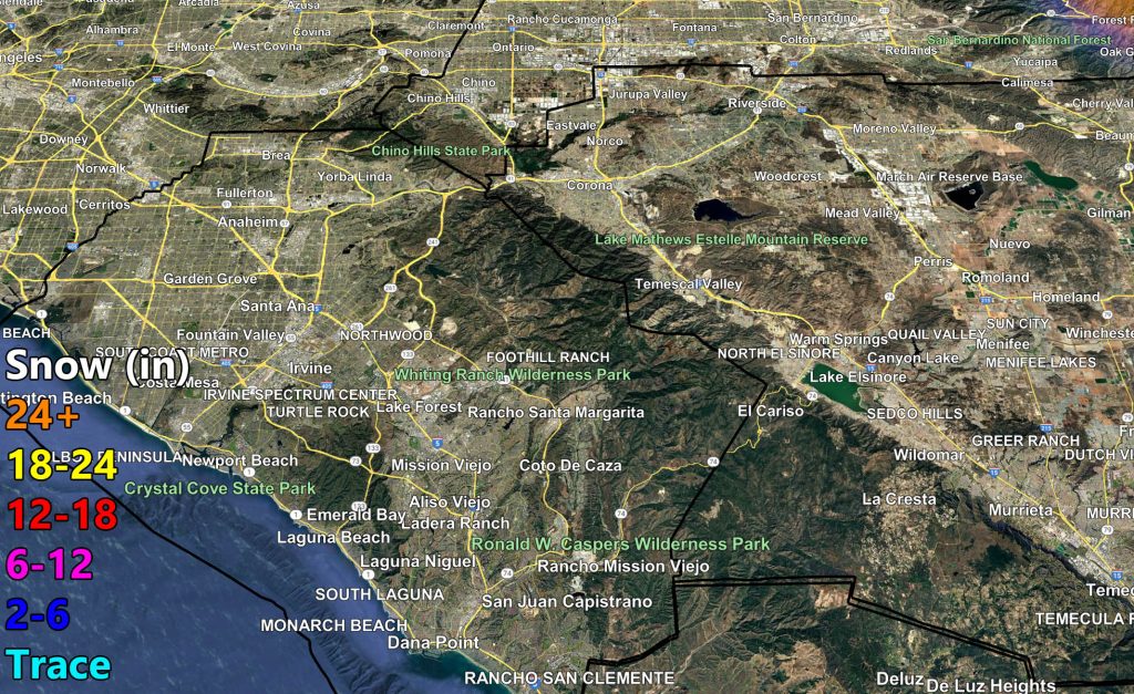
Snow (to zoom, right click and hit open image of some sort, or a device use your thumbs to zoom in)
![](https://www.southerncaliforniaweatherforce.com/wp-content/uploads/2025/02/2122025SnowA-1024x627.jpg)
![](https://www.southerncaliforniaweatherforce.com/wp-content/uploads/2025/02/2122025SnowB-1024x627.jpg)
![](https://www.southerncaliforniaweatherforce.com/wp-content/uploads/2025/02/2122025SnowD-1024x627.jpg)
![](https://www.southerncaliforniaweatherforce.com/wp-content/uploads/2025/02/2122025SnowC-1024x627.jpg)
![](https://www.southerncaliforniaweatherforce.com/wp-content/uploads/2025/02/2122025SnowE-1024x627.jpg)
![](https://www.southerncaliforniaweatherforce.com/wp-content/uploads/2025/02/2122025SnowF-1024x627.jpg)
![](https://www.southerncaliforniaweatherforce.com/wp-content/uploads/2025/02/2122025SnowH-1024x627.jpg)
![](https://www.southerncaliforniaweatherforce.com/wp-content/uploads/2025/02/2122025SnowG-1024x627.jpg)
![](https://www.southerncaliforniaweatherforce.com/wp-content/uploads/2025/02/2122025SnowI-1024x627.jpg)
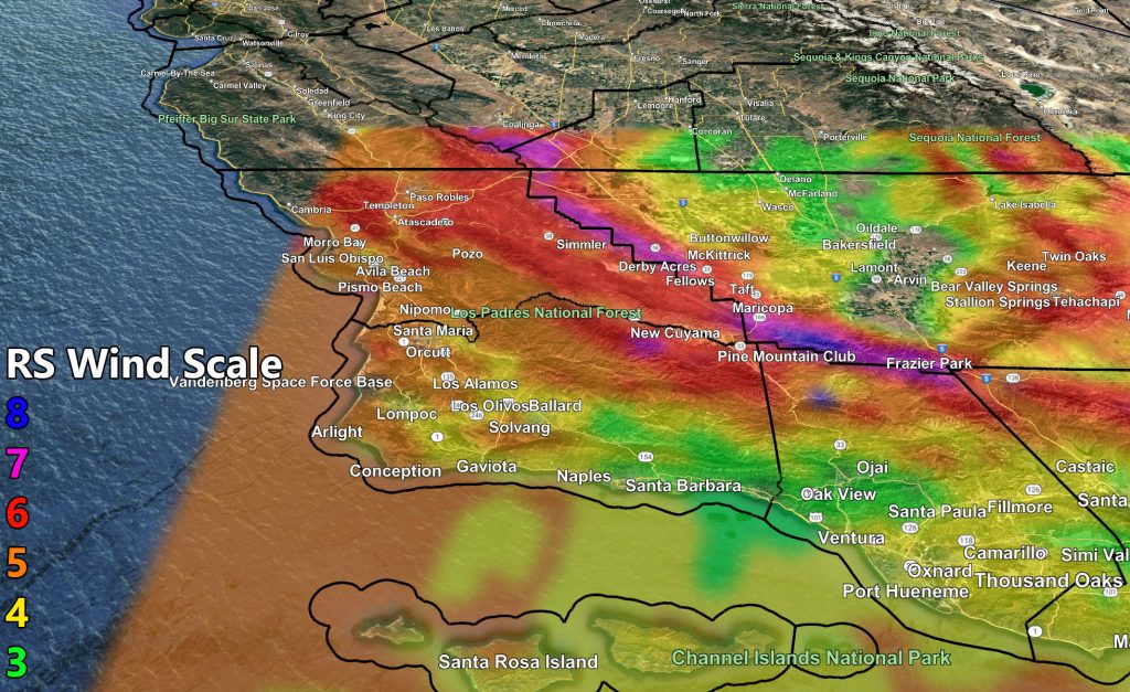
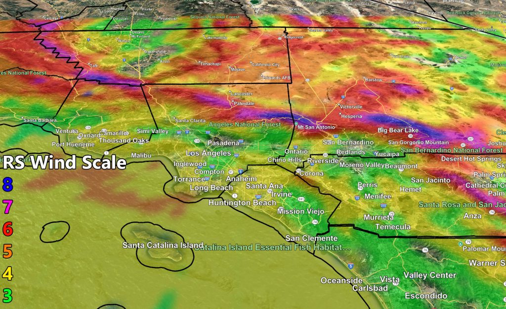
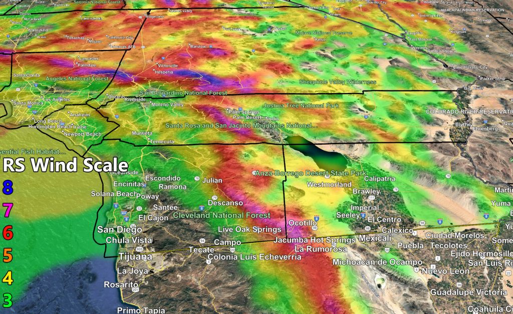
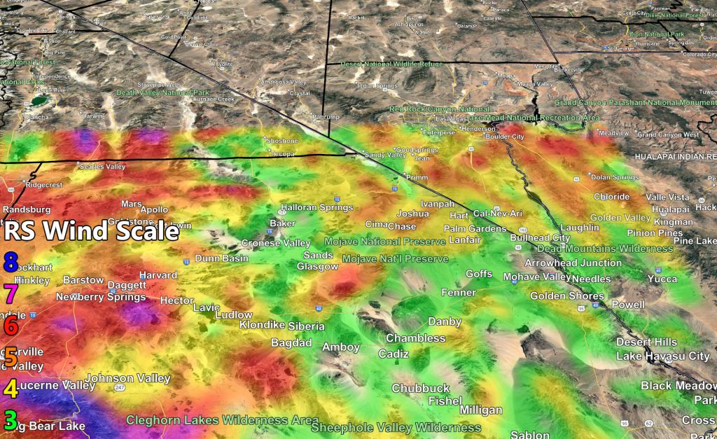
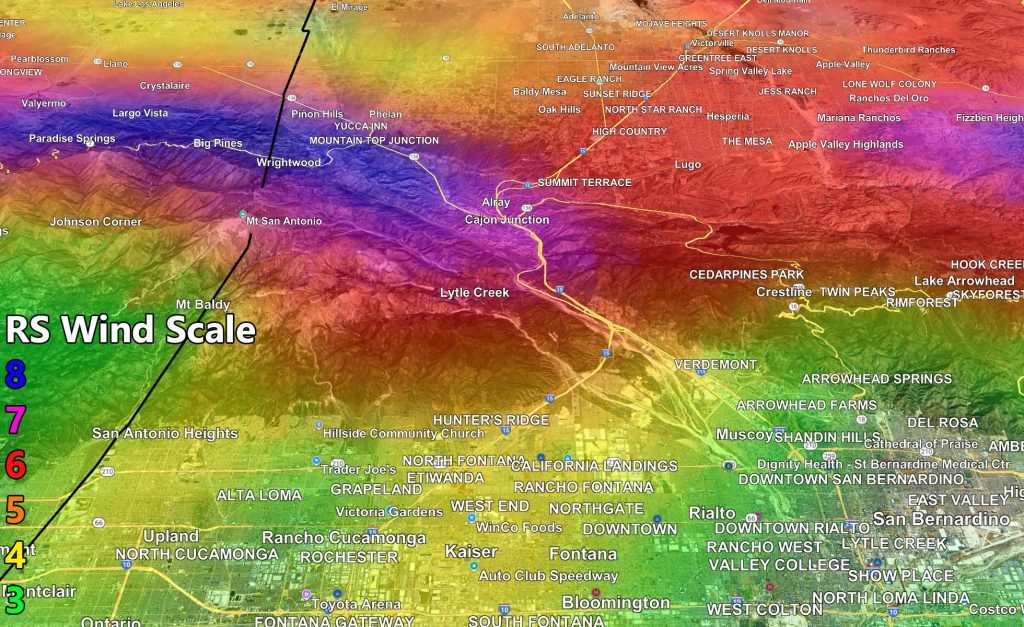
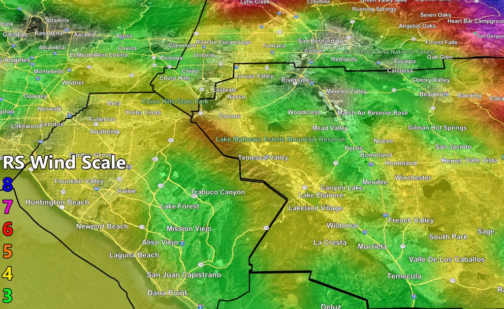
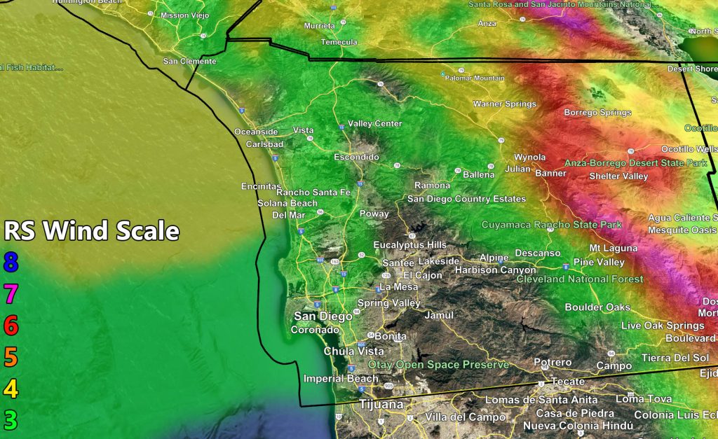
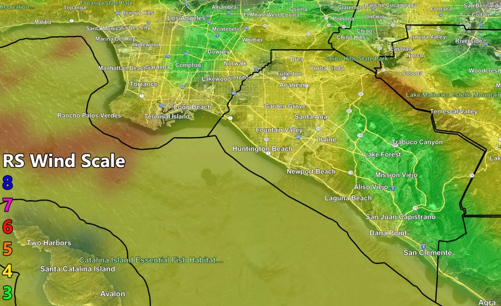
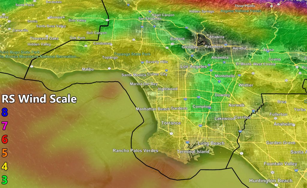
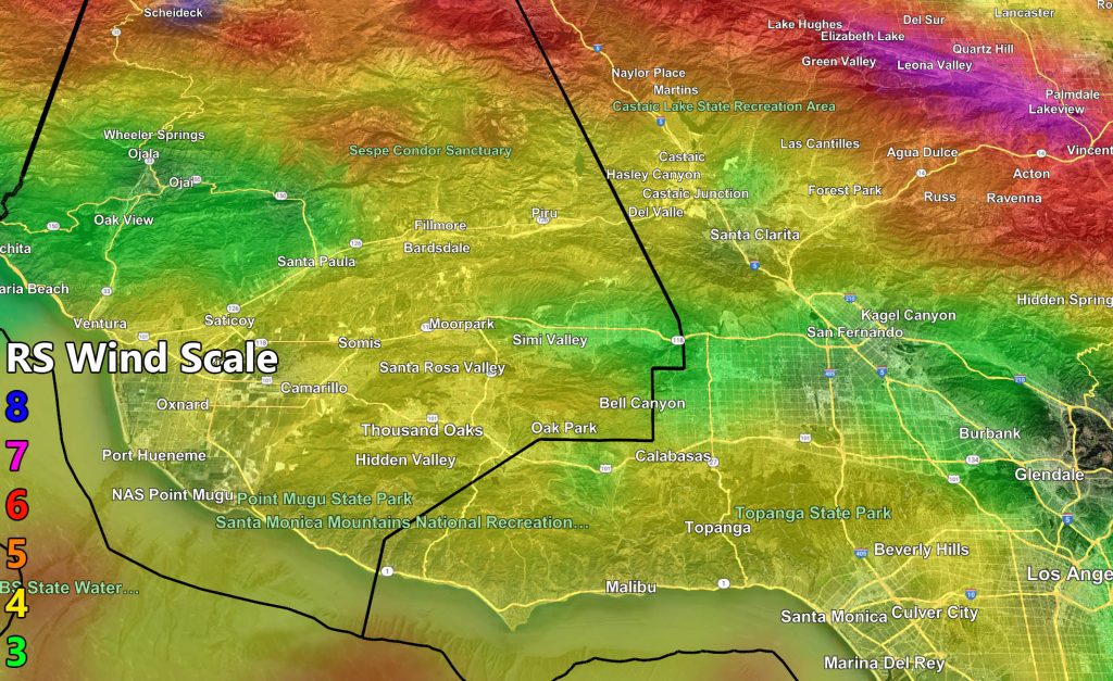
Wind (to zoom, right click and hit open image of some sort, or a device use your thumbs to zoom in)
Raiden Storm Wind Gust Intensity Scale –
8. Extensive widespread damage.
7. Trees are broken or uprooted, building damage is considerable. – High Profile Vehicle Roll-Over CERTAIN.
6. SOME Trees are broken or uprooted, building damage is possible. – High Profile Vehicle Roll-Over Likely, Do NOT recommend Traveling in this zone. This zone also is the starting zone where trees and powerlines will fall and damage cars and even kill people near or in them!
5. Slight damage occurs to buildings; shingles are blown off of roofs. HIGH WIND WARNING CRITERIA – High Profile Vehicle Roll-Over Possible if weight is not corrected.
4. Twigs and small branches are broken from trees, walking is difficult.
3. Large trees sway, becoming difficult to walk. POWER SHUTDOWN THRESHOLD DURING FIRE WEATHER / WIND ADVISORY CRITERIA
![](https://www.southerncaliforniaweatherforce.com/wp-content/uploads/2025/02/2122025WindA-1024x627.jpg)
![](https://www.southerncaliforniaweatherforce.com/wp-content/uploads/2025/02/2122025WindB-1024x627.jpg)
![](https://www.southerncaliforniaweatherforce.com/wp-content/uploads/2025/02/2122025WindC-1024x627.jpg)
![](https://www.southerncaliforniaweatherforce.com/wp-content/uploads/2025/02/2122025WindD-1024x627.jpg)
![](https://www.southerncaliforniaweatherforce.com/wp-content/uploads/2025/02/2122025WindE-1024x627.jpg)
![](https://www.southerncaliforniaweatherforce.com/wp-content/uploads/2025/02/2122025WindF-1024x627.jpg)
![](https://www.southerncaliforniaweatherforce.com/wp-content/uploads/2025/02/2122025WindG-1024x627.jpg)
![](https://www.southerncaliforniaweatherforce.com/wp-content/uploads/2025/02/2122025WindH-1024x627.jpg)
![](https://www.southerncaliforniaweatherforce.com/wp-content/uploads/2025/02/2122025WindI-1024x627.jpg)
![](https://www.southerncaliforniaweatherforce.com/wp-content/uploads/2025/02/2122025WindJ-1024x627.jpg)
Raiden Storm
Master General Meteorologist